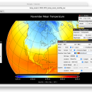
Panoply for Mac 5.4.3 freeware

... on the data, it can draw global longitude-latitude images or pole-to-pole latitude-vertical images.Panoply is a cross-platform application which plots geo-gridded arrays from netCDF, HDF and GRIB datasets. The utility can also combine two arrays and can project the analysis using more than 100 maps. ...

Author Robert B. Schmunk
Released 2024-06-24
Filesize 36.40 MB
Downloads 783
OS Mac OS X
Installation Instal And Uninstall
Keywords plot raster image, longitude image, pole-to-pole image, raster image, rasterize, raster
Users' rating
(29 rating)
Panoply for MacCADMac OS X
Panoply for Mac - multiple images Freeware Download Notice

Panoply for Mac Free Download - we do not host any Panoply for Mac torrent files or links of Panoply for Mac on rapidshare.com, depositfiles.com, megaupload.com etc. All Panoply for Mac download links are direct Panoply for Mac download from publisher site or their selected mirrors.

Panoply for Mac freeware - The Latest User Reviews
Panoply for Mac freeware - The Latest Versions History
5.4.3 Jun 24, 2024 New Release
5.4.1 Jun 1, 2024 New Release
5.4.0 May 11, 2024 New Release

Most popular CAD freeware downloads

Panoply for Mac

5.4.3 freeware download

... the Java Runtime, Panoply can be used on multiple platforms. The Panoply user interface is organized into multiple tabs that help you browse between datasets and ...

MagicPlot Student for Mac OS X

2.9.3 freeware download

... scaling * Visual nonlinear curve fitting * Vector images export and copying * Automatic formula recalculation on ... - Custom fit equations - Data processing - Multiple axes - Color map plots - Figure templates ...

pCon.planner

8.9.0.100 freeware download

... Optimal handling of data - Realistic, on-demand product images with OSPRay - Sharing of pCon.planner panoramas directly ... Quality - Rendering Animations with OSPRay - Exporting Multiple Real-Time Images and Panoramas - Real-Time Rendering Performance ...

MagicPlot Student for Linux

2.9.3 freeware download

... scaling * Visual nonlinear curve fitting * Vector images export and copying * Automatic formula recalculation on ... - Custom fit equations - Data processing - Multiple axes - Color map plots - Figure templates ...

MOPlot

1.93 freeware download

... shaded mode. Pages can be configured to hold multiple images of any kind that can be displayed on ...

JMARS

3.1.5 freeware download

... are a few of them: * Take multiple datasets (thermal inertia, mineral composition, digital elevations, etc.) ... or night), plot footprints and render remote sensing images from orbiters. * Correlate mineral compositions with topographic ...

5 freeware award

QFitsView

8.6 freeware download

... core, DS9 excels in displaying and analyzing astronomical images, supporting a wide array of file formats including ... noteworthy, ensuring that users can work with high-resolution images without performance bottlenecks. One of DS9's standout ...

BabaCAD

2.0.0 freeware download

... with bulges) Plot with scale, layout and multiple viewport support Use different colors, line types, ... widths by block or by layer Insert images of standard image formats (jpg, bmp, gif,...) ...

VEGA ZZ

3.2.3.28 freeware download

... the number and the type of colors. Multiple surface management. All 3D object can be ... software image rendering with the capability to create images bigger than the monitor size. The software rendering ...

JMARS for Windows

3.1.5 freeware download

... are a few of them: * Take multiple datasets (thermal inertia, mineral composition, digital elevations, etc.) ... or night), plot footprints and render remote sensing images from orbiters. * Correlate mineral compositions with topographic ...