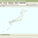
wxGIS Portable 0.4.1 freeware

... that allows you to manage and to organize multiple types of geographic information. The program has an ... systems in folders. It also includes a vector file export utility and a tool for correcting the orthographic data from raster TIFF files. ...

Author Dmitry Barishnikov
Released 2012-11-15
Filesize 9.70 MB
Downloads 344
OS Windows XP, Windows Vista, Windows Vista x64, Windows 7, Windows 7 x64
Installation Instal And Uninstall
Keywords GIS catalog, manage geography data, geographic coordinate system, manage, catalog, geography
Users' rating
(8 rating)
wxGIS PortableCADWindows XP, Windows Vista, Windows Vista x64, Windows 7, Windows 7 x64
wxGIS Portable - multiple file Freeware Download Notice

wxGIS Portable Free Download - we do not host any wxGIS Portable torrent files or links of wxGIS Portable on rapidshare.com, depositfiles.com, megaupload.com etc. All wxGIS Portable download links are direct wxGIS Portable download from publisher site or their selected mirrors.

wxGIS Portable freeware - The Latest User Reviews
wxGIS Portable freeware - The Latest Versions History
0.4.1 Nov 15, 2012 New Release · The DEM interpolation switch (bilinear or cubic) in orthocorrect tool
· Russian interface translation
· Rename item support
· Automatic rename output files in batch export
· The ortho-correction tool become more accurate and speedy

Most popular CAD freeware downloads

FilterPro Desktop

3.1.0.23446 freeware download

... using the Filter Design Wizard. Users can design multiple feedback (MFB), Sallen-Key, low-pass, high-pass, band-pass and band-stop ... Software offers the following features: NEW Differential Multiple-Feedback topology for Low-pass, High-pass, and Band-pass filters NEW ...

Jmol

14.31.53 freeware download

... Jmol's features include reading a variety of file types and output from quantum chemistry programs, and animation of multi-frame files and computed normal modes from quantum programs. ...

Jmol for Linux

14.31.53 freeware download

... Jmol's features include reading a variety of file types and output from quantum chemistry programs, and animation of multi-frame files and computed normal modes from quantum programs. ...

Mobile Atlas Creator

2.2.1 freeware download

... as one large PNG image with calibration MAP file for OziExplorer. As source for an offline atlas ... Trail Explorer (J2ME) - single tiles and MTECache file NaviComputer (Windows Mobile) nfComPass (WinCE, WinMobile, WinXP) OruxMaps ...

FreeMedForms

1.0.0 freeware download

... specialties and even veterinary profession. The patient file is fully editable. It is built with an XML file that you can modify to suit best for ...

Spirograph

1.0.2.1 freeware download

... animation · Export the created patterns to image file · Save you work for later use · Work with multiple spirograph patterns at the same time ...

SearchGUI for Mac and Linux

4.3.9 freeware download

... DirecTag. To start using SearchGUI, unzip the downloaded file, and double-click the SearchGUI-X.Y.Z.jar file. No additional installation required! The main purpose of SearchGUI is to make it simpler to use multiple search engines at the same time. We believe ...

MOPlot

1.93 freeware download

... optimization can be displayed and saved to a file. · Form linear combinations of vibrations. This feature ... shaded mode. Pages can be configured to hold multiple images of any kind that can be displayed ...

Weather Station Data Logger

5.6.0.0 freeware download

... time. Data is also logged to a CSV file with options for automatic backup and trimming. Daily extremes can be extracted from the log file and written to a separate CSV file. Data ...

CARIS Easy View

4.2.13 freeware download

... view spatial data imported from numerous types of files. It allows you to load multiple layers, change their order and adjust object parameters. ... view spatial data from a wide range of file types without the need for specialized software. ...