Thuban for Windows 1.2.2 freeware

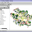
Thuban is an Interactive Geographic Data Viewer with the following features:

# Vector Data Support: Shapefile, PostGIS Layer and OGR
# Raster Data Support: GeoTIFF Layer and GDAL
# Comfortable Map Navigation
# Object Identification and Annotation
# Legend Editor and Classification
# Table Queries and Joins
# Projection Support
# Printing and Vector Export
# API for Add-Ons (Extensions) ...

Author Thuban Development Team
Released 2009-08-18
Filesize 11.22 MB
Downloads 449
OS Windows 2000, Windows 2003, Windows XP, Windows Vista
Installation Instal And Uninstall
Keywords geographic data viewer, gis viewer, analyze geographic information, information, geographic, viewer
Users' rating
(13 rating)
Thuban for WindowsCADWindows 2000, Windows 2003, Windows XP, Windows Vista
Thuban for Windows - multi language Freeware Download Notice

Thuban for Windows Free Download - we do not host any Thuban for Windows torrent files or links of Thuban for Windows on rapidshare.com, depositfiles.com, megaupload.com etc. All Thuban for Windows download links are direct Thuban for Windows download from publisher site or their selected mirrors.

Thuban for Windows freeware - The Latest User Reviews
Thuban for Windows freeware - The Latest Versions History
1.2.2 Aug 18, 2009 New Release

Most popular CAD freeware downloads

Jmol

14.31.53 freeware download

... output from quantum chemistry programs, and animation of multi-frame files and computed normal modes from quantum programs. ... component into other Java applications. · Translated into multiple languages: Catalan (ca), Chinese (both zh_CN and zh_TW) ...

Jmol for Linux

14.31.53 freeware download

... output from quantum chemistry programs, and animation of multi-frame files and computed normal modes from quantum programs. ... component into other Java applications. · Translated into multiple languages: Catalan (ca), Chinese (both zh_CN and zh_TW) ...

Thuban for Windows

1.2.2 freeware download

... Vector Export # API for Add-Ons (Extensions) # Multi-Language Support: English, French, German, Hungarian, Italian, Russian, Czech ... The Thuban User Interface is available for various languages: * English * French * German * ...

Thuban for Mac OS X

1.0.1-3 freeware download

... Vector Export # API for Add-Ons (Extensions) # Multi-Language Support: English, French, German, Hungarian, Italian, Russian, Czech ... The Thuban User Interface is available for various languages: * English * French * German * ...

Thuban for Linux

1.2.2 freeware download

... Vector Export # API for Add-Ons (Extensions) # Multi-Language Support: English, French, German, Hungarian, Italian, Russian, Czech ... The Thuban User Interface is available for various languages: * English * French * German * ...

OpalCalc

1.94 freeware download

... word processor, OpalCalc allows you to insert natural language as part of the sum, along with multi-line support so you can go back and adjust ... dedication. FEATURES: · Lightweight footprint · Multiline support (notepad style) · Configurable GUI with colour ...

OpalCalc Portable

1.94 freeware download

... word processor, OpalCalc allows you to insert natural language as part of the sum, along with multi-line support so you can go back and adjust ... dedication. FEATURES: · Lightweight footprint · Multiline support (notepad style) · Configurable GUI with colour ...

JMARS

3.1.5 freeware download

... are a few of them: * Take multiple datasets (thermal inertia, mineral composition, digital elevations, etc.) and overlay them into a single, registered multilayer image. * Make topographic profiles, extract surface temperatures ...

5 freeware award

Prode Valves

1.08 freeware download

... quick evaluation of valve's performance. * Connect to multiple databases to store and retrieve data, search data ... navigate between different items, access single user and multiuser archives, concurrent operations with items protected by passwords. ...

JMARS for Windows

3.1.5 freeware download

... are a few of them: * Take multiple datasets (thermal inertia, mineral composition, digital elevations, etc.) and overlay them into a single, registered multilayer image. * Make topographic profiles, extract surface temperatures ...