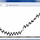
MuniWin for Linux 2.0.21 freeware

The C-Munipack is the software package, which offers the complete solution for reduction of images carried out by CCD camera, intended on a observation of variable stars. Each step of reduction process can be run from the command line or via simple and intuitive graphical user interface. ...

Author David Motl
Released 2016-02-01
Filesize 29.80 MB
Downloads 539
OS Linux
Installation Instal And Uninstall
Keywords image reduction, astrophotometry tool, CCD camera, reduce, reduction, astrophotometry
Users' rating
(12 rating)
MuniWin for LinuxCADLinux
MuniWin for Linux - modify system Freeware Download Notice

MuniWin for Linux Free Download - we do not host any MuniWin for Linux torrent files or links of MuniWin for Linux on rapidshare.com, depositfiles.com, megaupload.com etc. All MuniWin for Linux download links are direct MuniWin for Linux download from publisher site or their selected mirrors.

MuniWin for Linux freeware - The Latest User Reviews
MuniWin for Linux freeware - The Latest Versions History
2.0.21 Feb 1, 2016 New Release
2.0.17 Mar 30, 2015 New Release
2.0.16 Nov 26, 2014 New Release

Most popular CAD freeware downloads

MuniWin

2.1.13 freeware download

... therefore it is more portable to other operating systems and platforms. The package contains a few new ... language and can be run only on Windows system. C-Munipack program is free software; you can ...

MuniWin for Linux

2.0.21 freeware download

... therefore it is more portable to other operating systems and platforms. The package contains a few new ... language and can be run only on Windows system. C-Munipack program is free software; you can ...

TNTmips

20240404 freeware download

TNTmips software is a complete Geographic Information System (GIS) that lets you work with virtually any ... data types and a multitude of Coordinate Reference Systems. Include layers in a wide variety of external ...

AutoCAD Mobile

5.5.0.0 freeware download

... and draw shapes with Object Snap. Edit and Modify Drawings Edit geometry and select, move, rotate and scale objects within a drawing. Save to ...

TNTmips for Mac OS X

20240111 freeware download

TNTmips for Mac is a complete Geographic Information System (GIS) that lets you work with virtually any ... data types and a multitude of Coordinate Reference Systems. Include layers in a wide variety of external ...

ThermoFlo

2.0.9 freeware download

... different industries and applications. ThermoFlo uses a 1D Systems modeling approach which allows the user to use ... and testing for interchanging different components in a system or for tweaking properties of the model and ...

Elshayal Smart

23.02 freeware download

... vertexes, set vertex XY, move settings, converting coordinate system, applying VB script, copy selected features to another ... another layer, delete selected features, edit data table, modify table structure, edit map features, drawing new features, ...