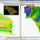
LanDTM 6.1 freeware

There is not any professional program on internet like this and you can get it without any effort. I think this could be a handicap because it's dificult to believe, but it's true; try it and you'll be surprised. It's not only a program to calculate a delaunay triangulation but you can input break-lines to get a real representation of the terrain. ...

Author Aplicaciones Topográficas S.L.
Released 2017-04-23
Filesize 58.80 MB
Downloads 610
OS Windows XP, Windows Vista, Windows Vista x64, Windows 7, Windows 7 x64, Windows 8, Windows 8 x64, Windows 10, Windows 10 x64
Installation Instal And Uninstall
Keywords Delaunay triangulation, Terrain Representation, CAD addon, Delaunay triangulation, Calculate, Terrain
Users' rating
(10 rating)
LanDTMCADWindows XP, Windows Vista, Windows Vista x64, Windows 7, Windows 7 x64, Windows 8, Windows 8 x64, Windows 10, Windows 10 x64
LanDTM - models Freeware Download Notice

LanDTM Free Download - we do not host any LanDTM torrent files or links of LanDTM on rapidshare.com, depositfiles.com, megaupload.com etc. All LanDTM download links are direct LanDTM download from publisher site or their selected mirrors.

LanDTM freeware - The Latest User Reviews
LanDTM freeware - The Latest Versions History
6.1 Apr 23, 2017 New Release
6.1.6 Feb 16, 2012 New Release · New installers of the program to 32 and 64 bits platforms.
· LanDTM on BricsCAD v12.
· LanDTM on Autocad 2012.
· Separator/discriminator of points.
· Compatibility with "gsf" grid files REDNAP of Geoid ondulation.
· Elevation modification of PPuntos.
· Importation/exportationn of Points to PPuntos.
· Compatibility between formats. Trimble M3, GPS Trimble, GSI of Stonex.
6.1.5 Oct 5, 2011 New Release · You can digitalize lines and points in Google Earth and export them to the CAD. It Works in BricsCAD v11.

Most popular CAD freeware downloads

FilterPro Desktop

3.1.0.23446 freeware download

FilterPro v3.1 active filter design software offers a new and improved user interface and a more accurate and robust active filter design engine, thanks to updates, ...

Model Air Design

1.8 freeware download

... new, quick and easy way to create airplane models. It's a modern software tool for model aircraft ... has a desire to design and create airplane models but have found Computer Aided Design (CAD) software ...

ThermoFlo

2.0.9 freeware download

... component is desired, ThermoFlo allows for incorporating 3D models into the system of other 1D components. ... system variable(s) Drag-and-Drop User Interface Simple creation of models by dragging and connecting parts onto the model ...

PAST

4.03 freeware download

... app is able to use linear or polynomial models and analyze the data diversity or geometric correlation. Although the basic statistical indicators such as mean, ...

QGIS

3.36.1 freeware download

... · Display raster data such as digital elevation models, aerial photography or landsat imagery · Change raster symbology (grayscale, pseudocolor and multiband RGB) · Export ...

DipTrace Free

4.3.0.0 freeware download

... built-in Pattern Generator that creates patterns and 3D models in no time. Besides, SnapEDA integration makes over ... libraries contain over 160,000 components and 11,500 3D models. ...

RADlab

1.03 freeware download

... radioactive sources are not avaliable. Analog Monte Carlo models are implemented for the decay of radiation sources ... radioactive sources are not avaliable. Analog Monte Carlo models are implemented for the decay of radiation sources ...

Model Air Design

2.4 freeware download

... new, fun and easy way to create airplane models. It's a modern software tool for aircraft design. ... has a desire to design and create airplane models but have found Computer Aided Design (CAD) software ...

QGIS for Mac

3.36.1 freeware download

... · Display raster data such as digital elevation models, aerial photography or landsat imagery · Change raster symbology (grayscale, pseudocolor and multiband RGB) · Export ...

QGIS for Linux

3.36.1 freeware download

... · Display raster data such as digital elevation models, aerial photography or landsat imagery · Change raster symbology (grayscale, pseudocolor and multiband RGB) · Export ...