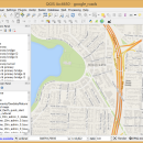
QGIS 3.36.1 freeware

QGIS supports vector, raster, and database formats and lets you browse and create map data on your computer.
QGIS supports many common spatial data formats (e.g. ESRI ShapeFile, geotiff). QGIS supports plugins to do things like display tracks from your GPS.
QGIS aims to be an easy to use GIS, providing common functions and features. The initial goal was to provide a GIS data viewer. ...

Author Gary Sherman
Released 2024-03-26
Filesize 1000.00 MB
Downloads 781
OS Windows XP, Windows Vista, Windows Vista x64, Windows 7, Windows 7 x64, Windows 8, Windows 8 x64, Windows 10, Windows 10 x64, Windows 11
Installation Instal And Uninstall
Keywords geographic information system, map creator, map viewer, GIS, geographic information, create, QGIS
Users' rating
(31 rating)
QGISCADWindows XP, Windows Vista, Windows Vista x64, Windows 7, Windows 7 x64, Windows 8, Windows 8 x64, Windows 10, Windows 10 x64, Windows 11
QGIS - measuring Freeware Download Notice

QGIS Free Download - we do not host any QGIS torrent files or links of QGIS on rapidshare.com, depositfiles.com, megaupload.com etc. All QGIS download links are direct QGIS download from publisher site or their selected mirrors.

QGIS freeware - The Latest User Reviews
QGIS freeware - The Latest Versions History
3.36.1 Mar 26, 2024 New Release
3.36.2 Apr 25, 2024 New Release
3.36.1 Mar 26, 2024 New Release

Most popular CAD freeware downloads

ShareCAD

2.0 freeware download

... and rotate images, change display modes and use measuring tools; - print drawings; - create temporary links that will allow other users to view uploaded ...

QGIS for Linux

3.36.1 freeware download

... attribute editing · Improved measure tools with area measuring · Attribute searching · New legend structure · Refactoring of API to allow the use of ...

pCon.planner

8.9.0.100 freeware download

... Sharing of pCon.planner panoramas directly onto Facebook - Measuring height of any selected object - Support for the drawing element "cylinder" for 3D operations - ...

QGIS

3.36.1 freeware download

... attribute editing · Improved measure tools with area measuring · Attribute searching · New legend structure · Refactoring of API to allow the use of ...

QGIS for Mac

3.36.1 freeware download

... attribute editing · Improved measure tools with area measuring · Attribute searching · New legend structure · Refactoring of API to allow the use of ...

Caliper2PC

2.7.3.15 freeware download

... East and possess a serial interface, over which measuring data can be transferred to other devices. Despite their price ($10 - $20) these calipers are ...

Gwyddion

2.66 freeware download

... distance and angle measurement · profiles: profile extraction, measuring distances in profile graph, profile export · filtering: mean, median, conservative denoise, Kuwahara, minimum, maximum, checker ...

Gwyddion for Linux

2.66 freeware download

... distance and angle measurement · profiles: profile extraction, measuring distances in profile graph, profile export · filtering: mean, median, conservative denoise, Kuwahara, minimum, maximum, checker ...

GOM Inspect

7.5 SR1 freeware download

... ... Free result viewer Full-field measuring data allows for an easy understanding of problematic areas and a faster finding of possible solutions. ...

Bootgraph CAD Viewer

6.1 freeware download

FREE CAD DWG viewer. Key feature highlights: 1. Fast DWG viewer 2. Smart QS calculation: 3. The perfect integration of CAD and Excel: 4. Quick interaction ...