Open3DQSAR 2.24 freeware

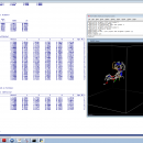
Open3DQSAR is an open-source tool aimed at pharmacophore exploration by high-throughput chemometric analysis of molecular interaction fields (MIFs). Open3DQSAR can generate steric potential, electron density and MM/QM electrostatic potential fields; furthermore, it can import GRIDKONT binary files produced by GRID and CoMFA/CoMSIA fields (exported from SYBYL with the aid of a small SPL script). ...

Author Paolo Tosco
Released 2013-06-20
Filesize 1.01 MB
Downloads 559
OS Windows XP, Windows Vista, Windows 7
Installation Instal And Uninstall
Keywords chemometric analysis, analyze MIF, pharmacophore exploration, MIF, analysis, chemometry
Users' rating
(9 rating)
Open3DQSARCADWindows XP, Windows Vista, Windows 7
Open3DQSAR - maps Freeware Download Notice

Open3DQSAR Free Download - we do not host any Open3DQSAR torrent files or links of Open3DQSAR on rapidshare.com, depositfiles.com, megaupload.com etc. All Open3DQSAR download links are direct Open3DQSAR download from publisher site or their selected mirrors.

Open3DQSAR freeware - The Latest User Reviews
Open3DQSAR freeware - The Latest Versions History
2.24 Jun 20, 2013 New Release · A bug which caused abrupt program exit when PyMOL was closed while Open3DQSAR was still running was fixed
· Linking against libminizip is now optional
2.23 Jan 25, 2013 New Release · A bug in the import type=DEPENDENT keyword which caused an error message whenever attempting to import multiple dependent variables was fixed
2.22 Jan 4, 2013 New Release · The new type=MOE_GRID parameter was added to the prepare keyword to allow preparing a shape vector for the computation of interaction potentials within MOE using the same grid box settings as defined in Open3DQSAR
· The new type=MOE_GRID parameter was added to the import keyword to allow importing in Open3DQSAR the interaction potential grids computed within MOE
· The WriteMOEGRID.svl SVL script has been added to the util folder
· Minor bugfixes all over

Most popular CAD freeware downloads

Panoply for Mac

5.4.3 freeware download

... can project the analysis using more than 100 maps. What’s more, you get to overlay continent, or other types of masks on top of the ...

QFitsView

8.6 freeware download

... experience with a variety of scaling options, color maps, and region definitions, enabling precise control over how data is presented. This flexibility is crucial for ...

Gwyddion

2.66 freeware download

... color or material representation · easily editable color maps and OpenGL materials · basic operations: rotation, flipping, inversion, data arithmetic, crop, resampling · leveling: plane ...

Gwyddion for Linux

2.66 freeware download

... color or material representation · easily editable color maps and OpenGL materials · basic operations: rotation, flipping, inversion, data arithmetic, crop, resampling · leveling: plane ...

UCL Depthmap

0.8.0 freeware download

... where the derivation algorithm becomes cumbersome, pre-drawn axial maps may be imported. Axial maps may be broken into segment maps, or segment maps, such as road-centre line maps, ...

GpsTools Studio

2.3.1 build 227 freeware download

... GpsGate Server users that want to create custom maps in order to use them for tracking the GPS devices. The program allows you to import ...

TNTatlas

2024 B20240606 freeware download

... viewer that lets you publish and distribute your maps and geospatial data — from a single geodata ... part in the way we work and live. Maps, drawings, photos and related materials may be the ...

TNTmips

20240404 freeware download

... formats without importing. Overlay your geodata on Bing Maps imagery and maps or on geodata layers published on the Internet ...

CARIS Easy View

4.2.13 freeware download

... types of files, as various GIS applications save maps and models to a wide array of formats. CARIS Easy View supports a wide range file ...

TNTatlas for Mac OS X

2024 B20240508 freeware download

... viewer that lets you publish and distribute your maps and geospatial data — from a single geodata ... part in the way we work and live. Maps, drawings, photos and related materials may be the ...