GpsTools Studio 2.3.1 build 227 freeware

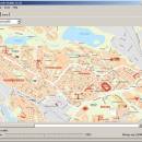
... GpsGate Server users that want to create custom maps in order to use them for tracking the GPS devices. The program allows you to import a map from a popular image file and to export it to a compatible format. ...

Author Franson Technology
Released 2012-11-21
Filesize 3.80 MB
Downloads 407
OS Windows XP, Windows Vista, Windows Vista x64, Windows 7, Windows 7 x64, Windows 8, Windows 8 x64, Windows 10, Windows 10 x64
Installation Instal And Uninstall
Keywords create map, import GpsGate map, scale image, map, creator, create
Users' rating
(13 rating)
GpsTools StudioCADWindows XP, Windows Vista, Windows Vista x64, Windows 7, Windows 7 x64, Windows 8, Windows 8 x64, Windows 10, Windows 10 x64
GpsTools Studio - maps Freeware Download Notice

GpsTools Studio Free Download - we do not host any GpsTools Studio torrent files or links of GpsTools Studio on rapidshare.com, depositfiles.com, megaupload.com etc. All GpsTools Studio download links are direct GpsTools Studio download from publisher site or their selected mirrors.

GpsTools Studio freeware - The Latest User Reviews
GpsTools Studio freeware - The Latest Versions History
2.3.1 build Nov 21, 2012 New Release

Most popular CAD freeware downloads

Panoply for Mac

5.4.3 freeware download

... can project the analysis using more than 100 maps. What’s more, you get to overlay continent, or other types of masks on top of the ...

TNTatlas for Mac OS X

2024 B20240508 freeware download

... viewer that lets you publish and distribute your maps and geospatial data — from a single geodata ... part in the way we work and live. Maps, drawings, photos and related materials may be the ...

TNTmips

20240404 freeware download

... formats without importing. Overlay your geodata on Bing Maps imagery and maps or on geodata layers published on the Internet ...

Open3DQSAR x64

2.24 freeware download

... · Comprehensive output, including SDF molecular databases, 3D maps and many different plots to ease immediate evaluation ... of QM electron density and electrostatic potential 3D maps from within Open3DQSAR · User-friendly interface to Molecular ...

TNTatlas

2024 B20240606 freeware download

... viewer that lets you publish and distribute your maps and geospatial data — from a single geodata ... part in the way we work and live. Maps, drawings, photos and related materials may be the ...

JMARS for Windows

3.1.5 freeware download

... roughness data with thermal inertia data. * Contour maps may be created. * Groups of layers can ... THEMIS, Viking, and CTX; topography from MOLA; compositional maps from TES and GRS/HEND; albedo and thermal inertia ...

Mobile Atlas Creator

2.2.1 freeware download

... applications please see the features section. Additionally individual maps can be exported as one large PNG image ... can use a large number of different online maps such as OpenStreetMap, Google Maps, Yahoo Maps and ...

Open3DQSAR for Mac OS X

2.24 freeware download

... · Comprehensive output, including SDF molecular databases, 3D maps and many different plots to ease immediate evaluation ... of QM electron density and electrostatic potential 3D maps from within Open3DQSAR · User-friendly interface to Molecular ...

JMARS

3.1.5 freeware download

... roughness data with thermal inertia data. * Contour maps may be created. * Groups of layers can ... THEMIS, Viking, and CTX; topography from MOLA; compositional maps from TES and GRS/HEND; albedo and thermal inertia ...

5 freeware award

CARIS Easy View

4.2.13 freeware download

... types of files, as various GIS applications save maps and models to a wide array of formats. CARIS Easy View supports a wide range file ...