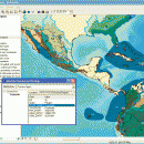
ArcReader 10.5.0 B6491 freeware

ArcReader is a free, easy-to-use desktop mapping application that allows users to view, explore, and print maps and globes. ArcReader is a free and easy-to-use application that allows users to view and print maps that are published as Published Map Files (PMF) by the ArcGIS Publisher extension to ArcView, ArcEditor, and ArcInfo. ...

Author ESRI
Released 2017-02-02
Filesize 444.00 MB
Downloads 551
OS Windows XP, Windows Vista, Windows Vista x64, Windows 7, Windows 7 x64, Windows 8, Windows 8 x64
Installation Instal And Uninstall
Keywords view map, print PMF map, export bitmap, view, viewer, map, print
Users' rating
(20 rating)
ArcReaderCADWindows XP, Windows Vista, Windows Vista x64, Windows 7, Windows 7 x64, Windows 8, Windows 8 x64
ArcReader - mapping Freeware Download Notice

ArcReader Free Download - we do not host any ArcReader torrent files or links of ArcReader on rapidshare.com, depositfiles.com, megaupload.com etc. All ArcReader download links are direct ArcReader download from publisher site or their selected mirrors.

ArcReader freeware - The Latest User Reviews
ArcReader freeware - The Latest Versions History
10.5.0 B6491 Feb 2, 2017 New Release
10.4 B5524 Apr 10, 2016 New Release
10.3 B4332 Jan 2, 2015 New Release

Most popular CAD freeware downloads

Gwyddion for Linux

2.66 freeware download

... visualization: false color representation with different types of mapping · shaded, logarithmical, gradient- and edge-detected, local contrast representation, Canny lines · OpenGL 3D data display: ...

QFitsView

8.6 freeware download

... in the study of the cosmos. Whether you're mapping the intricate structures of a nebula or analyzing the light curves of distant stars, DS9 provides ...

QGIS

3.36.1 freeware download

... to allow the use of QGIS libraries in mapping applications · Improved MapServer export tool · Vector layer transparency and antialiasing · GRASS support in ...

Gwyddion

2.66 freeware download

... visualization: false color representation with different types of mapping · shaded, logarithmical, gradient- and edge-detected, local contrast representation, Canny lines · OpenGL 3D data display: ...

QGIS for Mac

3.36.1 freeware download

... to allow the use of QGIS libraries in mapping applications · Improved MapServer export tool · Vector layer transparency and antialiasing · GRASS support in ...

QGIS for Linux

3.36.1 freeware download

... to allow the use of QGIS libraries in mapping applications · Improved MapServer export tool · Vector layer transparency and antialiasing · GRASS support in ...

Doodles 3D

0.76 freeware download

Doodles 3D is a handy application designed to help you create 3D models by adding points and connecting them to form shapes. The program allows you ...

CyFluxViz

0.92 freeware download

... reactions (flux subetwork) or arbitrary network attributes Flexible mapping architecture for all visual attributes Full integration with CySBML Export of views in variety of formats ...

TrueSpace

7.61 freeware download

... shows the rendered character (left), and the UV mapping for his head and face in the UV Editor (right). Behavioral animations: · Objects in ...

Aqsis Renderer for Windows

1.8.2 freeware download

... * Subdivision Surfaces (SDS) * High quality texture mapping * Level of Detal (LOD) * High Dynamic Range (HDR) Output * Extensible through plugins (DSO/Procedurals) ...