UCL Depthmap 0.8.0 freeware

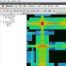
Depthmap is a single software platform to perform a set of spatial network analyses designed to understand social processes within the built environment. It works at a variety of scales from building through small urban to whole cities or states. ...

Author University College London
Released 2020-11-08
Filesize 35.10 MB
Downloads 1375
OS Windows XP, Windows Vista, Windows Vista x64, Windows 7, Windows 7 x64, Windows 8, Windows 8 x64, Windows 10, Windows 10 x64, Windows 11
Installation Instal And Uninstall
Keywords urban environment, urban map, spatial network analysis, environment, map, analysis
Users' rating
(27 rating)
UCL DepthmapCADWindows XP, Windows Vista, Windows Vista x64, Windows 7, Windows 7 x64, Windows 8, Windows 8 x64, Windows 10, Windows 10 x64, Windows 11
UCL Depthmap - map Freeware Download Notice

UCL Depthmap Free Download - we do not host any UCL Depthmap torrent files or links of UCL Depthmap on rapidshare.com, depositfiles.com, megaupload.com etc. All UCL Depthmap download links are direct UCL Depthmap download from publisher site or their selected mirrors.

UCL Depthmap freeware - The Latest User Reviews
UCL Depthmap freeware - The Latest Versions History
0.8.0 Nov 8, 2020 New Release General:
Allow for pushing values from shapemaps (axial maps, segment maps) to VGA
Fix VGA map connections export
Make drawing to segment conversion faster
Test and fix shape removal for axial and data maps
Allow pushing the Ref or Key value to another layer
Fix MIF/MID import (allow for empty columns, PR #369)
Fix diagonal line handling on VGA map fill (PR #326, thanks Piotr Piastucki!)
Change C++ standard to 17
Graphical User Interface (GUI):
Highlight shapes and pixels on hover (can be disabled in the settings)
Allow inserting any number in the table (PR #356)
Fix a case where the app would crash with multiple unlinking in VGA (PR #328)
Fix convex map hover and selection (PR #368)
Allow generating multiple isovists by importing a CSV file
Fix a case where VGA progress bar would end, but analysis would still be going (PR #323)
0.7.0 Jun 7, 2019 New Release
0.30 Sep 18, 2014 New Release

Most popular CAD freeware downloads

Panoply for Mac

5.4.3 freeware download

... one plot by differencing, summing or averaging. Create map plots of trajectory data based on the CF ... Plot lon-lat data on a global or regional map using any of over 200 map projections or ...

TNTatlas for Mac OS X

2024 B20240508 freeware download

... — from a single geodata file to complex map layouts prepared using TNTmips. TNTatlas lets you display ... have to rapidly assemble and distribute existing electronic map and database materials for those working in natural ...

TrueSpace

7.61 freeware download

... that need different textures, and then export that map to a 2D editor so that you can draw and create the textures needed. · ...

MagicPlot Student

2.9.3 freeware download

... - Data processing - Multiple axes - Color map plots - Figure templates - Batch processing ...

MagicPlot Student for Mac OS X

2.9.3 freeware download

... - Data processing - Multiple axes - Color map plots - Figure templates - Batch processing ...

MagicPlot Student for Linux

2.9.3 freeware download

... - Data processing - Multiple axes - Color map plots - Figure templates - Batch processing ...

Thuban for Windows

1.2.2 freeware download

... Data Support: GeoTIFF Layer and GDAL # Comfortable Map Navigation # Object Identification and Annotation # Legend ... falls into five major parts: * Map * Legend * Statusbar * Toolbar and * ...

Open Visual Trace Route

1.7.1 freeware download

... Traceroute Packet sniffer Whois 3D and 2D Map visualisation Export data to image or text Gantt view ...

Engauge Digitizer for Windows

12.0 freeware download

... converts an image file showing a graph or map, into numbers. The image file can come from ... with an image file containing a graph or map. The final result is digitized data that can ...

5 freeware award

Engauge Digitizer for Mac OS X

12.0 freeware download

... converts an image file showing a graph or map, into numbers. The image file can come from ... with an image file containing a graph or map. The final result is digitized data that can ...

5 freeware award