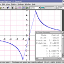
Engauge Digitizer for Mac OS X 12.0 freeware

... converts an image file showing a graph or map, into numbers. The image file can come from ... with an image file containing a graph or map. The final result is digitized data that can be used by other tools such as Microsoft Excel. ...

Author Mark Mitchell
Released 2019-08-19
Filesize 10.10 MB
Downloads 881
OS Mac OS X
Installation Instal And Uninstall
Keywords digitize image, image to number, process image, digitize, convert, digitizer
Users' rating
(18 rating)
Engauge Digitizer for Mac OS XCADMac OS X
Our rating 5 freeware award
Engauge Digitizer for Mac OS X - map Freeware Download Notice

Engauge Digitizer for Mac OS X Free Download - we do not host any Engauge Digitizer for Mac OS X torrent files or links of Engauge Digitizer for Mac OS X on rapidshare.com, depositfiles.com, megaupload.com etc. All Engauge Digitizer for Mac OS X download links are direct Engauge Digitizer for Mac OS X download from publisher site or their selected mirrors.

Engauge Digitizer for Mac OS X freeware - The Latest User Reviews
Engauge Digitizer for Mac OS X freeware - The Latest Versions History
12.0 Aug 19, 2019 New Release New hourglass and triangle point types (#346)
Fix data export for log scale data when step factor is less than one (#345)
10.4 Oct 11, 2017 New Release Show warning message when grid line maximum is exceed (#244)
CSV export files have double quotes on fields with internal commas (#243)
Status bar shows all of text for right-to-left languages (#240)
5.1 Dec 24, 2012 New Release Fix for broken point matching, and control of the x/theta axis label.

Most popular CAD freeware downloads

Panoply for Mac

5.4.3 freeware download

... one plot by differencing, summing or averaging. Create map plots of trajectory data based on the CF ... Plot lon-lat data on a global or regional map using any of over 200 map projections or ...

QGIS for Mac

3.36.1 freeware download

... database formats and lets you browse and create map data on your computer. QGIS supports many ... On the fly projection of vector layers · Map composer · Identify features · Display attribute table ...

UCL Depthmap

0.8.0 freeware download

... aim of the software is to produce a map of open space elements, connect them via some ... Depthmap can be used to derive an ‘axial map’ of a layout. That is, derive a reduced ...

CARIS Easy View

4.2.13 freeware download

CARIS Easy View is a simple application that enables you to view spatial data imported from numerous types of files. It allows you to load multiple ...

SoundStepper

5.4.1.304 freeware download

... telescope control, such as for example a sky map, autoguiding, or capture images from a webcam or CCD. In this system, for Windows, the ...

JMARS

3.1.5 freeware download

... be created by drawing multi-segment lines on the map, making it easy to sample elevation, thermal inertia, ... common formats. * Edit vector data on the map or in a table. * Use vector processing ...

5 freeware award

GpsTools Studio

2.3.1 build 227 freeware download

... devices. The program allows you to import a map from a popular image file and to export ... The user can easily scale the map image by using the wizard available in the ...

Bifido Punnett Square Calculator Pro

3.4 freeware download

... it includes: Punnett Square Calculator Crossing Over Map Calculator Fruit Fly Sex Calculator Recombination Progeny Calculator ...

TNTatlas

2024 B20240606 freeware download

... — from a single geodata file to complex map layouts prepared using TNTmips. TNTatlas lets you display ... have to rapidly assemble and distribute existing electronic map and database materials for those working in natural ...

JMARS for Windows

3.1.5 freeware download

... be created by drawing multi-segment lines on the map, making it easy to sample elevation, thermal inertia, ... common formats. * Edit vector data on the map or in a table. * Use vector processing ...