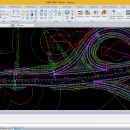
BimRoad Plus freeware

Parametric road design. The world's first software for automatic interchange design. Three-dimensional alignment design. Real-time interchange redesign considering design standards by changing the main alignment. All type of interchange design using user defined connection road. Automatic connection road plan by editing nose point. Automatic correction of road plan design element using parametric method. ...

Author HaneeSoft
Released 2015-01-01
Filesize 232.65 MB
Downloads 263
OS Win2000, Windows XP, Windows 7 x32, Windows 7 x64, Windows 8, Windows 10, WinServer, WinOther, Windows Vista, Windows Vista x64
Installation Install and Uninstall
Keywords Road design, Interchange design, Alignment, Earthwork
Users' rating
(11 rating)
BimRoadCADWin2000, Windows XP, Windows 7 x32, Windows 7 x64, Windows 8, Windows 10, WinServer, WinOther, Windows Vista, Windows Vista x64
BimRoad - map Freeware Download Notice

BimRoad Free Download - we do not host any BimRoad torrent files or links of BimRoad on rapidshare.com, depositfiles.com, megaupload.com etc. All BimRoad download links are direct BimRoad download from publisher site or their selected mirrors.

BimRoad freeware - The Latest User Reviews
BimRoad freeware - The Latest Versions History
Plus Jan 1, 2015 New Release Road design.
Topography creation.
Plane design.
Profile Design.
Interchange automatic design.
Cross section design.
Earthwork.
Hydraulics.
Report / Drawing.

Most popular CAD freeware downloads

Panoply for Mac

5.4.3 freeware download

... one plot by differencing, summing or averaging. Create map plots of trajectory data based on the CF ... Plot lon-lat data on a global or regional map using any of over 200 map projections or ...

Engauge Digitizer for Windows

12.0 freeware download

... converts an image file showing a graph or map, into numbers. The image file can come from ... with an image file containing a graph or map. The final result is digitized data that can ...

5 freeware award

Mobile Atlas Creator

2.2.1 freeware download

... exported as one large PNG image with calibration MAP file for OziExplorer. As source for an offline ... OpenStreetMap, Google Maps, Yahoo Maps and other online map providers. Features: Create offline atlases for ...

Engauge Digitizer for Mac OS X

12.0 freeware download

... converts an image file showing a graph or map, into numbers. The image file can come from ... with an image file containing a graph or map. The final result is digitized data that can ...

5 freeware award

ArcReader

10.5.0 B6491 freeware download

... and print maps that are published as Published Map Files (PMF) by the ArcGIS Publisher extension to ... and professionals alike. Zoom, pan, and switch between map and page layout views. Communicate more efficiently with ...

QGIS for Linux

3.36.1 freeware download

... database formats and lets you browse and create map data on your computer. QGIS supports many ... On the fly projection of vector layers · Map composer · Identify features · Display attribute table ...

MagicPlot Student for Mac OS X

2.9.3 freeware download

... - Data processing - Multiple axes - Color map plots - Figure templates - Batch processing ...

Mobile Atlas Creator for Mac OS X

2.2.1 freeware download

... exported as one large PNG image with calibration MAP file for OziExplorer. As source for an offline ... OpenStreetMap, Google Maps, Yahoo Maps and other online map providers. Features: Create offline atlases for ...

UCL Depthmap

0.8.0 freeware download

... aim of the software is to produce a map of open space elements, connect them via some ... Depthmap can be used to derive an ‘axial map’ of a layout. That is, derive a reduced ...

SoundStepper

5.4.1.304 freeware download

... telescope control, such as for example a sky map, autoguiding, or capture images from a webcam or CCD. In this system, for Windows, the ...