- Freeware
- - Graphic Apps
- - CAD
- - GraceGTK
GraceGTK 0.9.0 freeware
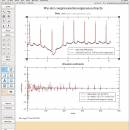
GraceGTK is a small, simple, easy to use application specially designed to offer you an evolution of the Grace grapher. It is based on the GTK API with higher interactivity and new features such as a tree view of the drawing and contour levels curves. ...
| Author | Patrick Vincent |
| Released | 2019-02-15 |
| Filesize | 15.40 MB |
| Downloads | 904 |
| OS | Windows XP, Windows Vista, Windows Vista x64, Windows 7, Windows 7 x64, Windows 8, Windows 8 x64, Windows 10, Windows 10 x64 |
| Installation | Instal And Uninstall |
| Keywords | create graph, graph editor, edit graph, creator, edit, editor |
| Users' rating (9 rating) |
GraceGTK Free Download - we do not host any GraceGTK torrent files or links of GraceGTK on rapidshare.com, depositfiles.com, megaupload.com etc. All GraceGTK download links are direct GraceGTK download from publisher site or their selected mirrors.
| 0.9.0 | Jul 19, 2017 | New Release | Some bugs removed (e.g. compile wo NetCDF or int in region limits) Names rationalization continue (e.g. ssdata -> block_data) Changes to remove deprecated functions in GTK+2.24 to prepare for GTK3 in progress but not yet operational. |
| 0.9.5 | Sep 27, 2016 | New Release | Add drag and drop capability for *.agr, *.dat, *.fig and *.nc files Add possible execution on selection of multiple sets + in TreeView for script in the Commands window, + in source/dest lists for the Non linear fit window. (see new Advanced/Scripting example.) Add Fit page button and GUI size choice in Preference window Handling of objects had been changed: by default only handles can be used to move or copy objects (behavior may be changed in the Preference window). Rescaling of arcs had been revised Added to the interpreter (see advanced scripting example) |
| 0.9.1 | Jun 12, 2014 | New Release | NetCDF files import is reestablished from grace-5 and enhanced NetCDF export is added. TARGET command is extended to data columns and 1D arrays. XYCMAP may be now defined by giving only z column and defining the grid by two corners A new vector product is introduced: v1 TP v2 produces a vector of length dim(v1) x dim(v2) Windows binaries are now compiled under VISTA |


