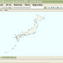
wxGIS Portable 0.4.1 freeware

... is a useful application that allows you to manage and to organize multiple types of geographic information. ... for correcting the orthographic data from raster TIFF files. ...

Author Dmitry Barishnikov
Released 2012-11-15
Filesize 9.70 MB
Downloads 342
OS Windows XP, Windows Vista, Windows Vista x64, Windows 7, Windows 7 x64
Installation Instal And Uninstall
Keywords GIS catalog, manage geography data, geographic coordinate system, manage, catalog, geography
Users' rating
(5 rating)
wxGIS PortableCADWindows XP, Windows Vista, Windows Vista x64, Windows 7, Windows 7 x64
wxGIS Portable - manage files Freeware Download Notice

wxGIS Portable Free Download - we do not host any wxGIS Portable torrent files or links of wxGIS Portable on rapidshare.com, depositfiles.com, megaupload.com etc. All wxGIS Portable download links are direct wxGIS Portable download from publisher site or their selected mirrors.

wxGIS Portable freeware - The Latest User Reviews
wxGIS Portable freeware - The Latest Versions History
0.4.1 Nov 15, 2012 New Release · The DEM interpolation switch (bilinear or cubic) in orthocorrect tool
· Russian interface translation
· Rename item support
· Automatic rename output files in batch export
· The ortho-correction tool become more accurate and speedy

Most popular CAD freeware downloads

CityCAD Viewer

2.7.0 freeware download

... CityCAD. With CityCAD Viewer you can also manage groups and phases, and add costs, values and some movement information. ...

BabaCAD

2.0.0 freeware download

... lisps for any purpose. Supports standard CAD files (*.DWG, *.DXF) Edit fast and save your ... your own LISP command icons and load .lsp files on startup. Object snap (end-point, mid-point, intersection, ...

wxGIS

0.2.0 freeware download

... is a useful application that allows you to manage and to organize multiple types of geographic information. ... for correcting the orthographic data from raster TIFF files. ...

wxGIS Portable

0.4.1 freeware download

... is a useful application that allows you to manage and to organize multiple types of geographic information. ... for correcting the orthographic data from raster TIFF files. ...

GstarCAD MC

3.3.1 freeware download

... edit CAD drawings ( DWG, OCF and DXF files) directly on your mobile device after transferring them. ... Move, Copy, Rotate, Scale, Color, Measure object, record management results, manage layers and use Layout. • Advanced ...