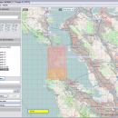
Mobile Atlas Creator 2.2.1 freeware

Mobile Atlas Creator is a small, simple, Java based application specially designed to help you create atlases for TrekBuddy. Basically this software will create offline atlases for GPS handhelds and cell phone applications like TrekBuddy, AndNav and other Android and WindowsCE based applications. ...

Author Fredrik Moller
Released 2021-06-02
Filesize 15.00 MB
Downloads 2245
OS Windows XP, Windows Vista, Windows Vista x64, Windows 7, Windows 7 x64, Windows 8, Windows 8 x64, Windows 10, Windows 10 x64, Linux
Installation Instal And Uninstall
Keywords create atlas, generate atlas, atlas creator, generator, generate, create
Users' rating
(25 rating)
Mobile Atlas CreatorCADWindows XP, Windows Vista, Windows Vista x64, Windows 7, Windows 7 x64, Windows 8, Windows 8 x64, Windows 10, Windows 10 x64, Linux
Mobile Atlas Creator - load Freeware Download Notice

Mobile Atlas Creator Free Download - we do not host any Mobile Atlas Creator torrent files or links of Mobile Atlas Creator on rapidshare.com, depositfiles.com, megaupload.com etc. All Mobile Atlas Creator download links are direct Mobile Atlas Creator download from publisher site or their selected mirrors.

Mobile Atlas Creator freeware - The Latest User Reviews
Mobile Atlas Creator freeware - The Latest Versions History
2.2.1 Jun 2, 2021 New Release
2.1.3 Rev 24 Apr 14, 2020 New Release Minimum supported Java version increased to Java 8 (1.8)
"mapFile must not be null" error when creating an atlas
Save settings to settings.xml in UTF-8 format (fix for #324)
Map creation error with JPEG (Garmin Custom and others) (fix for #326)
2.1.2 Rev 24 Oct 11, 2019 New Release Minimum supported Java version increased to Java 8 (1.8)
"mapFile must not be null" error when creating an atlas
Save settings to settings.xml in UTF-8 format (fix for #324)
Map creation error with JPEG (Garmin Custom and others) (fix for #326)

Most popular CAD freeware downloads

Portable MicroDicom

2024.2 freeware download

... DICOMDIR Display images from different studies or examinations Load via drag&drop or double-click Convert DICOM images to the most common picture formats, movie file format(.avi) ...

pCon.planner

8.9.0.100 freeware download

... manufacturers and dealers in the furnishing industry. You load the objects directly into your planning and thus equip the rooms with real high-quality 3D models. ...

Mobile Atlas Creator

2.2.1 freeware download

... map sources map resolutions (zoom levels)... Save and load your favorite atlas compilation as profile to/from file Merge different layers using Drag & Drop Create ...

AutoFEM Analysis Lite

1.7 freeware download

... natural frequency of structure; - calculation of critical load (the stability of the system); - oscillations analysis; ... so called as a "Study". The model is loaded into the preprocessor AutoFEM which is fully integrated ...

5 freeware award

Mobile Atlas Creator for Mac OS X

2.2.1 freeware download

... map sources map resolutions (zoom levels)... Save and load your favorite atlas compilation as profile to/from file Merge different layers using Drag & Drop Create ...

DSI Studio

.59 freeware download

... Studio can be directly imported by Matlab. · Load trk files generated by TrackVis Coregistration: · Insert T1/T2 images in tractography by linear transform ...

Cytoscape x64

3.10.0 freeware download

... or spreadsheet programs. Using this feature, you can load and save arbitrary attributes on nodes, edges, and ... molecular and systems biology, genomics, and proteomics: Load molecular and genetic interaction data sets in many ...

BabaCAD

2.0.0 freeware download

... CAD. Create your own LISP command icons and load .lsp files on startup. Object snap (end-point, mid-point, intersection, nearest, perpendicular) Tracking and coordinates ...

Geogiga Front End

9.0 freeware download

Geogiga Front End is designed to QC and preprocess single shot record. You can convert data formats, analyze amplitude decay, correct trigger delay, assign geometry, mute ...

JMARS for Windows

3.1.5 freeware download

... surface properties in an area of interest. * Load and process raw numeric rasters, which may be stretched and colorized on the fly. * Load and process vector data in several common formats. ...