Engauge Digitizer for Windows 12.0 freeware

Engauge Digitizer - Digitizing software

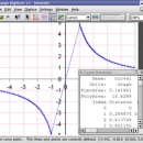
This open source, digitizing software converts an image file showing a graph or map, into numbers. The image file can come from a scanner, digital camera or screenshot. The numbers can be read on the screen, and written or copied to a spreadsheet.

The process starts with an image file containing a graph or map. The final result is digitized data that can be used by other tools such as ...

Author Mark Mitchell
Released 2019-08-19
Filesize 10.60 MB
Downloads 919
OS Windows 2000, Windows 2003, Windows XP, Windows Vista, Windows Vista x64
Installation Instal And Uninstall
Keywords digitize image, image to number, process image, digitize, convert, digitizer
Users' rating
(26 rating)
Engauge Digitizer for WindowsCADWindows 2000, Windows 2003, Windows XP, Windows Vista, Windows Vista x64
Our rating 5 freeware award
Engauge Digitizer for Windows - lines Freeware Download Notice

Engauge Digitizer for Windows Free Download - we do not host any Engauge Digitizer for Windows torrent files or links of Engauge Digitizer for Windows on rapidshare.com, depositfiles.com, megaupload.com etc. All Engauge Digitizer for Windows download links are direct Engauge Digitizer for Windows download from publisher site or their selected mirrors.

Engauge Digitizer for Windows freeware - The Latest User Reviews
Engauge Digitizer for Windows freeware - The Latest Versions History
12.0 Aug 19, 2019 New Release
10.4 Oct 11, 2017 New Release Show warning message when grid line maximum is exceed (#244)
CSV export files have double quotes on fields with internal commas (#243)
Status bar shows all of text for right-to-left languages (#240)
5.1 Dec 24, 2012 New Release Fix for broken point matching, and control of the x/theta axis label.

Most popular CAD freeware downloads

HeeksCAD

0.20.0 freeware download

... STEP and IGES files. Draw construction geometry and lines and arcs. Create new primitive solids, or make ... or to HPGL. Import and export dxf files; lines, arcs, ellipses, splines and polylines are supported. Use ...

HeeksCNC

0.22.0 freeware download

... code is then shown as red and green lines on the screen. The NC code is generated using Python script, so it can be configured ...

Gwyddion

2.66 freeware download

... logarithmical, gradient- and edge-detected, local contrast representation, Canny lines · OpenGL 3D data display: false color or ... facet leveling, polynomial background removal, leveling along user-defined lines · value reading, distance and angle measurement · ...

Gwyddion for Linux

2.66 freeware download

... logarithmical, gradient- and edge-detected, local contrast representation, Canny lines · OpenGL 3D data display: false color or ... facet leveling, polynomial background removal, leveling along user-defined lines · value reading, distance and angle measurement · ...

p3d

2.6.2 freeware download

... any combination and number of emission and absorption lines in the data. The fitted data are written to binary-table fits files as well as multi-extension ...

Gnuplot for Windows

5.2.7 freeware download

... either 2D and 3D. It can draw using lines, points, boxes, contours, vector fields, surfaces, and various associated text. It also supports various specialized plot ...

RElim

4.4 freeware download

... done in one recursive function of fairly few lines of code. Papers that describes the algorithm underlying this program (that is, the program relim, ...

JMARS

3.1.5 freeware download

... * Plots may be created by drawing multi-segment lines on the map, making it easy to sample elevation, thermal inertia, or other surface properties in ...

5 freeware award

X-Sweet Home 3D

4.4 [rev18] freeware download

... · Annotate the plan with room areas, dimension lines, texts and show the North direction with a compass rose · Create photorealistic images and videos ...

Pro Yacht

1.0.0.1 freeware download

... analysed using gaussian and mean curvature and reflection lines, and hydrostatic properties reviewed. Once a design is complete, a fully annotated lines plan drawing of the hull surface can be ...