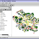
Thuban for Windows 1.2.2 freeware

Thuban is an Interactive Geographic Data Viewer with the following features:

# Vector Data Support: Shapefile, PostGIS Layer and OGR
# Raster Data Support: GeoTIFF Layer and GDAL
# Comfortable Map Navigation
# Object Identification and Annotation
# Legend Editor and Classification
# Table Queries and Joins
# Projection Support
# Printing and Vector Export
# API for Add-Ons (Extensions) ...

Author Thuban Development Team
Released 2009-08-18
Filesize 11.22 MB
Downloads 447
OS Windows 2000, Windows 2003, Windows XP, Windows Vista
Installation Instal And Uninstall
Keywords geographic data viewer, gis viewer, analyze geographic information, information, geographic, viewer
Users' rating
(12 rating)
Thuban for WindowsCADWindows 2000, Windows 2003, Windows XP, Windows Vista
Thuban for Windows - layers Freeware Download Notice

Thuban for Windows Free Download - we do not host any Thuban for Windows torrent files or links of Thuban for Windows on rapidshare.com, depositfiles.com, megaupload.com etc. All Thuban for Windows download links are direct Thuban for Windows download from publisher site or their selected mirrors.

Thuban for Windows freeware - The Latest User Reviews
Thuban for Windows freeware - The Latest Versions History
1.2.2 Aug 18, 2009 New Release

Most popular CAD freeware downloads

Balancer Lite

2.1.0.448 freeware download

... large but has many small independent meshes or layers, you can still use Balancer Lite. Before loading your model, enable Balancer to split the model ...

Mobile Atlas Creator

2.2.1 freeware download

... u-blox and others Prepare atlases consisting of multiple layers, different map sources map resolutions (zoom levels)... Save ... atlas compilation as profile to/from file Merge different layers using Drag & Drop Create map tiles using ...

Mobile Atlas Creator for Mac OS X

2.2.1 freeware download

... u-blox and others Prepare atlases consisting of multiple layers, different map sources map resolutions (zoom levels)... Save ... atlas compilation as profile to/from file Merge different layers using Drag & Drop Create map tiles using ...

ArcReader

10.5.0 B6491 freeware download

... be contained in these maps through the multiple layers supported by PMF documents can be viewed up close using the zooming functions of ArcReader. It ...

QGIS

3.36.1 freeware download

... analysis · On the fly projection of vector layers · Map composer · Identify features · Display attribute table · Select features · Label features ...

QGIS for Linux

3.36.1 freeware download

... analysis · On the fly projection of vector layers · Map composer · Identify features · Display attribute table · Select features · Label features ...

CiDess

4.28 freeware download

... you can write text on CU1 and/or CU2 layers - Planar components creation - PCB and layout can be saved as GIF and BMP pictures ...

UCL Depthmap

0.8.0 freeware download

... and the measures may be transferred to gate layers in order to compare with indicators of pedestrian or social behaviour. For larger systems where the ...

Thuban for Mac OS X

1.0.1-3 freeware download

... properties dialog mainly focusses on the legend: The layers objects can be grouped by single values or ranges. Visibility and symbols can be edited per ...

JMARS

3.1.5 freeware download

... Contour maps may be created. * Groups of layers can be composed by transparency blending or building an HSV/RGB composite. * Plots may be created ...

5 freeware award