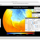
Panoply for Mac 5.4.3 freeware

... an utility that enable user to plot raster image. Depending on the data, it can draw global longitude-latitude images or pole-to-pole latitude-vertical images.Panoply is a cross-platform application which plots geo-gridded arrays from netCDF, HDF and GRIB datasets. The utility can also combine two arrays and can project the analysis using more than 100 maps. ...

Author Robert B. Schmunk
Released 2024-06-24
Filesize 36.40 MB
Downloads 783
OS Mac OS X
Installation Instal And Uninstall
Keywords plot raster image, longitude image, pole-to-pole image, raster image, rasterize, raster
Users' rating
(29 rating)
Panoply for MacCADMac OS X
Panoply for Mac - into image Freeware Download Notice

Panoply for Mac Free Download - we do not host any Panoply for Mac torrent files or links of Panoply for Mac on rapidshare.com, depositfiles.com, megaupload.com etc. All Panoply for Mac download links are direct Panoply for Mac download from publisher site or their selected mirrors.

Panoply for Mac freeware - The Latest User Reviews
Panoply for Mac freeware - The Latest Versions History
5.4.3 Jun 24, 2024 New Release
5.4.1 Jun 1, 2024 New Release
5.4.0 May 11, 2024 New Release

Most popular CAD freeware downloads

Panoply for Mac

5.4.3 freeware download

... platforms. The Panoply user interface is organized into multiple tabs that help you browse between datasets ... to disk GIF, JPEG, PNG or TIFF bitmap images or as PDF or PostScript graphics files. Export ...

pCon.planner

8.9.0.100 freeware download

... the furnishing industry. You load the objects directly into your planning and thus equip the rooms with ... Optimal handling of data - Realistic, on-demand product images with OSPRay - Sharing of pCon.planner panoramas directly ...

Engauge Digitizer for Windows

12.0 freeware download

... This open source, digitizing software converts an image file showing a graph or map, into numbers. The image file can come from a scanner, digital camera ...

5 freeware award

Engauge Digitizer for Linux

12.0 freeware download

... This open source, digitizing software converts an image file showing a graph or map, into numbers. The image file can come from a scanner, digital camera ...

JMARS for Windows

3.1.5 freeware download

... terabyte of NASA orbiter data, and has basic image and vector processing features to conveniently compare, plot, ... mineral composition, digital elevations, etc.) and overlay them into a single, registered multilayer image. * Make topographic ...

MuniWin for Linux

2.0.21 freeware download

... which offers the complete solution for reduction of images carried out by CCD camera, intended on a ... a set of bias, dark and flat frames into high quality master-bias, master-dark and master-flat correction frames ...

PFind

2.8.3.0 freeware download

PFind lets you organize your images, put into categories. Select some images, choose the category (which you can define easily) and put into this category. Do that with some images. ...

JMARS

3.1.5 freeware download

... terabyte of NASA orbiter data, and has basic image and vector processing features to conveniently compare, plot, ... mineral composition, digital elevations, etc.) and overlay them into a single, registered multilayer image. * Make topographic ...

5 freeware award

Engauge Digitizer for Mac OS X

12.0 freeware download

... This open source, digitizing software converts an image file showing a graph or map, into numbers. The image file can come from a scanner, digital camera ...

5 freeware award

TrueSpace

7.61 freeware download

... and render 3D content. As well as traditional images and movies, you can also make 3D content ... lets you save your trueSpace creations to load into game engines such as XNA to develop games ...