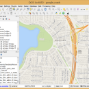
QGIS for Mac 3.36.1 freeware

QGIS supports vector, raster, and database formats and lets you browse and create map data on your computer.
QGIS supports many common spatial data formats (e.g. ESRI ShapeFile, geotiff). QGIS supports plugins to do things like display tracks from your GPS.
QGIS aims to be an easy to use GIS, providing common functions and features. The initial goal was to provide a GIS data viewer. ...

Author Gary Sherman
Released 2024-03-26
Filesize 1600.00 MB
Downloads 775
OS Mac OS X
Installation Instal And Uninstall
Keywords geographic information system, map creator, map viewer, GIS, geographic information, create, QGIS for Mac
Users' rating
(31 rating)
QGIS for MacCADMac OS X
QGIS for Mac - information Freeware Download Notice

QGIS for Mac Free Download - we do not host any QGIS for Mac torrent files or links of QGIS for Mac on rapidshare.com, depositfiles.com, megaupload.com etc. All QGIS for Mac download links are direct QGIS for Mac download from publisher site or their selected mirrors.

QGIS for Mac freeware - The Latest User Reviews
QGIS for Mac freeware - The Latest Versions History
3.36.1 Mar 26, 2024 New Release
3.36.2 Apr 25, 2024 New Release
3.36.1 Mar 26, 2024 New Release

Most popular CAD freeware downloads

TNTatlas for Mac OS X

2024 B20240508 freeware download

... JP2, PNG, MrSID, DXF, and DWG. Geospatial information plays a growing part in the way we ... concern in your professional life, or such spatial information may be a growing secondary responsibility. Your duties ...

MarvinSketch

23.16.0 freeware download

... atoms, via “S-group” logic so that any user-defined information can be stored directly with the structural information. FEATURES: Chemical structure drawing Molecular modeling

PyPedal

2.0.3 freeware download

... IDs, parents younger than offspring, etc.) Generating summary information such as frequency of appearance in the pedigree ... matrices, coefficients of inbreeding and relationship, and summary information Importation and exportation of GEDCOM 5.5 files Importation ...

GProX

1.1.16 freeware download

... Plot regulations in an instant · Request database information of-the-fly Enrichment Analysis: · Test for over-represented protein features · Select from several statistical approaches ...

eMachineShop 3D CAD

1.52 freeware download

... change. Like the price? Enter yrour credit card information and in a few weeks, your finished parts arrive - in spec and on time - ...

Thuban for Windows

1.2.2 freeware download

... features methods to visualize, explore, and analyze geographic information. Thuban is an Interactive Geographic Data Viewer ... need for a user-friendly, interactive viewer for geographic information. Thuban makes use of several Free GIS ...

Virtual Terrain Project for Windows

1.1 110804 freeware download

... visual simulation, surveying and remote sensing. VTP gathers information and tracks progress in areas such as procedural scene construction, feature extraction, and rendering algorithms. VTP ...

TDSL Personal Edition

1.1.1.40 freeware download

... TDSL (Tube Data Sheet Locator) Personal Edition provides information right on your PC for a large number of vacuum tubes. Advanced searching facilities help you ...

enCIFer for Linux

1.4 freeware download

The Crystallographic Information File (CIF) is the internationally agreed standard file format for information exchange in crystallography. The CIF standard is supported, ... archives. enCIFer should also be used to add information safely to CIFs without corrupting the strict syntax. ...

TNTatlas

2024 B20240606 freeware download

... JP2, PNG, MrSID, DXF, and DWG. Geospatial information plays a growing part in the way we ... concern in your professional life, or such spatial information may be a growing secondary responsibility. Your duties ...