QGIS for Linux 3.36.1 freeware

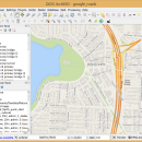
QGIS supports vector, raster, and database formats and lets you browse and create map data on your computer.
QGIS supports many common spatial data formats (e.g. ESRI ShapeFile, geotiff). QGIS supports plugins to do things like display tracks from your GPS.
QGIS aims to be an easy to use GIS, providing common functions and features. The initial goal was to provide a GIS data viewer. ...

Author Gary Sherman
Released 2024-03-26
Filesize 1.00 MB
Downloads 783
OS Linux
Installation Instal And Uninstall
Keywords geographic information system, map creator, map viewer, GIS, geographic information, create, QGIS for Linux
Users' rating
(34 rating)
QGIS for LinuxCADLinux
QGIS for Linux - information Freeware Download Notice

QGIS for Linux Free Download - we do not host any QGIS for Linux torrent files or links of QGIS for Linux on rapidshare.com, depositfiles.com, megaupload.com etc. All QGIS for Linux download links are direct QGIS for Linux download from publisher site or their selected mirrors.

QGIS for Linux freeware - The Latest User Reviews
QGIS for Linux freeware - The Latest Versions History
3.36.1 Mar 26, 2024 New Release
3.36.2 Apr 25, 2024 New Release
3.36.1 Mar 26, 2024 New Release

Most popular CAD freeware downloads

MarvinSketch

23.16.0 freeware download

... atoms, via “S-group” logic so that any user-defined information can be stored directly with the structural information. FEATURES: Chemical structure drawing Molecular modeling

QGIS for Mac

3.36.1 freeware download

QGIS is a professional GIS application that is built on top of and proud to be itself Free and Open Source Software (FOSS). QGIS supports ...

UCL Depthmap

0.8.0 freeware download

... agent is able to access the visual accessibility information for its current location from the visibility graph, and this informs its choice of next destination. ...

Pro Yacht

1.0.0.1 freeware download

... introduction of new realisation code to manage all information extracted from surfaces. While the hull transformation functions developed for X-Topology surfaces are omitted in this ...

JDet

1.4.1 freeware download

... recently developed programs for extracting this kind of information from protein alignments. This software has been developed by Thilo Muth and Juan Antonio Garcia ...

KMWin

1.52 freeware download

... limits and labels, marking censored times, adding an information text or a legend, inverting survival time curves, displaying a table with cases under risk, performing ...

GProX

1.1.16 freeware download

... Plot regulations in an instant · Request database information of-the-fly Enrichment Analysis: · Test for over-represented protein features · Select from several statistical approaches ...

TNTatlas

2024 B20240606 freeware download

... JP2, PNG, MrSID, DXF, and DWG. Geospatial information plays a growing part in the way we ... concern in your professional life, or such spatial information may be a growing secondary responsibility. Your duties ...

TNTmips

20240404 freeware download

TNTmips software is a complete Geographic Information System (GIS) that lets you work with virtually ... of natural terrains and mathematical surfaces from 3D information. Fast and efficient Surface Fitting, Contouring, and Triangulation ...

PAST for Mac OS X

4.03 freeware download

... manipulation techniques in order to extract relevant statistical information. To conclude, Past is a great tool to ... the imported data. Note that Past can extract information from text files, and you get to decide ...