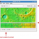
JMARS for Windows 3.1.5 freeware

... Analysis for Remote Sensing. It is a geospatial information system (GIS) developed by ASU's Mars Space Flight Facility to provide mission planning and data-analysis tools to NASA's orbiters, instrument team members, students of all ages, and the general public. ...

Author Arizona State University
Released 2014-08-12
Filesize 50.00 MB
Downloads 552
OS Windows Vista, Windows Vista x64, Windows 7, Windows 7 x64
Installation Instal And Uninstall
Keywords mission analysis, geospatial information, GIS analysis, mission, analysis, GIS
Users' rating
(15 rating)
JMARS for WindowsCADWindows Vista, Windows Vista x64, Windows 7, Windows 7 x64
JMARS for Windows - information Freeware Download Notice

JMARS for Windows Free Download - we do not host any JMARS for Windows torrent files or links of JMARS for Windows on rapidshare.com, depositfiles.com, megaupload.com etc. All JMARS for Windows download links are direct JMARS for Windows download from publisher site or their selected mirrors.

JMARS for Windows freeware - The Latest User Reviews
JMARS for Windows freeware - The Latest Versions History
3.1.5 Aug 12, 2014 New Release - In JMARS, locate the "Options" tab at the top of the screen, click it
- Click "Check for Updates"
3.0.4 Jun 7, 2013 New Release - minor change that will allow users to use Body->reset layers to reset layers to JMARS default/startup state
- minor bug fix in the interaction of the Main view and Panner views
- accuracy of crater layer settings improved when saving crater layers as part of a saved session
- more graceful error handling when loading a saved session
- removed the ESRI option from the list for loading/saving in the shape layer. The Geo tools ESRI option is the replacement
- a fix for a drawing issue in the TES layer on Mac OS X running Java 7
- lower right corner coordinates added to the high resolution export tool including new UI functionality for setting export height and width
- update to how image corners (lat/lon) are specified in high resolution export
- added CSV export and look and feel changes to the Investigate tool
- improved communication between the Stamp Layer and backend databases
- Add Layer UI look and feel improvements
- ease of use changes to crater counting layer for small bodies

Most popular CAD freeware downloads

MarvinSketch

23.16.0 freeware download

... atoms, via “S-group” logic so that any user-defined information can be stored directly with the structural information. FEATURES: Chemical structure drawing Molecular modeling

TexGen

3.11.0 freeware download

... On this website you will find all the information necessary to get started with TexGen by using the sidebar for navigation. Please leave a message ...

MOPlot

1.93 freeware download

... populations (for open shell systems), if the corresponding information is available in the output of the calculation. · Molecular orbitals (hence the name of the ...

Jmol for Linux

14.31.53 freeware download

... based application designed to display various 3D chemical information. Jmol's features include reading a variety of file types and output from quantum chemistry programs, ...

Weather Station Data Logger

5.6.0.0 freeware download

... the raw console data yields the following additional information: * 15-minute rate of change for temperature ... is updated once a minute with the following information: * Station and altitude-corrected pressure. * 1-minute ...

ArcReader

10.5.0 B6491 freeware download

... new way for individuals and enterprises to share information that was once limited to those with advanced GIS software on their computers. With ArcReader, ...

Jmol

14.31.53 freeware download

... based application designed to display various 3D chemical information. Jmol's features include reading a variety of file types and output from quantum chemistry programs, ...

OpenRocket

14.06 freeware download

... CP position Real-time flight altitude, velocity and acceleration information from a continuous simulation performed in the background Zoomable schematic view of rocket from the side ...

Thuban for Mac OS X

1.0.1-3 freeware download

... features methods to visualize, explore, and analyze geographic information. Thuban is an Interactive Geographic Data Viewer ... need for a user-friendly, interactive viewer for geographic information. Thuban makes use of several Free GIS ...

SketchEl

1.60 freeware download

... MOL file format, though not not necessarily without information loss. Molecule diagrams are rendered interactively in high quality, and can also be exported as SVG ...