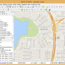
QGIS for Linux 3.36.1 freeware

QGIS supports vector, raster, and database formats and lets you browse and create map data on your computer.
QGIS supports many common spatial data formats (e.g. ESRI ShapeFile, geotiff). QGIS supports plugins to do things like display tracks from your GPS.
QGIS aims to be an easy to use GIS, providing common functions and features. The initial goal was to provide a GIS data viewer. ...

Author Gary Sherman
Released 2024-03-26
Filesize 1.00 MB
Downloads 794
OS Linux
Installation Instal And Uninstall
Keywords geographic information system, map creator, map viewer, GIS, geographic information, create, QGIS for Linux
Users' rating
(38 rating)
QGIS for LinuxCADLinux
QGIS for Linux - information analysis Freeware Download Notice

QGIS for Linux Free Download - we do not host any QGIS for Linux torrent files or links of QGIS for Linux on rapidshare.com, depositfiles.com, megaupload.com etc. All QGIS for Linux download links are direct QGIS for Linux download from publisher site or their selected mirrors.

QGIS for Linux freeware - The Latest User Reviews
QGIS for Linux freeware - The Latest Versions History
3.36.1 Mar 26, 2024 New Release
3.36.2 Apr 25, 2024 New Release
3.36.1 Mar 26, 2024 New Release

Most popular CAD freeware downloads

Cirrus Seismic Evaluation

2.5 freeware download

... to save the data or to print the analysis information displayed in the main window. ...

QGIS for Linux

3.36.1 freeware download

... files · GRASS integration, including view, edit, and analysis · On the fly projection of vector layers · Map composer · Identify features · Display ...

GProX

1.1.16 freeware download

... available complete software platform for comprehensive and integrated analysis and visualization of large proteomics datasets. The program provides a range of functions for data analysis. User-friendly program layout: · Spreadsheet data ...

Qualyzer

1.2.1 freeware download

Qualyzer is a handy, easy to use application designed to support researchers conducting qualitative inquiries by helping them manage participants, transcripts, and memos. ...

DWSIM

6.6.2 freeware download

... Refluxed and Reboiled Absorbers. DWSIM also provides special information about the simulation and different means of inputting ... Characterization, Reactions Manager and User Component Creator Process Analysis and Optimization: Sensitivity Analysis Utility, Multivariate Optimizer with ...

Thuban for Windows

1.2.2 freeware download

... features methods to visualize, explore, and analyze geographic information. Thuban is an Interactive Geographic Data Viewer ... need for a user-friendly, interactive viewer for geographic information. Thuban makes use of several Free GIS ...

OpenRAVE

0.9.0 freeware download

... applications. The main focus is on simulation and analysis of kinematic and geometric information related to motion planning. OpenRAVE’s stand-alone nature allows ...

JMARS

3.1.5 freeware download

... an acronym that stands for Java Mission-planning and Analysis for Remote Sensing. It is a geospatial information system (GIS) developed by ASU's Mars Space Flight ... examine datasets from past missions. For more information, see the abstract from the JMARS presentation at ...

5 freeware award

Weather Station Data Logger

5.6.0.0 freeware download

... most of the data available on the console, analysis of wind and temperature data plus graphs of ... the raw console data yields the following additional information: * 15-minute rate of change for temperature ...

JMARS for Windows

3.1.5 freeware download

... an acronym that stands for Java Mission-planning and Analysis for Remote Sensing. It is a geospatial information system (GIS) developed by ASU's Mars Space Flight ... examine datasets from past missions. For more information, see the abstract from the JMARS presentation at ...