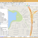
QGIS 3.36.1 freeware

QGIS supports vector, raster, and database formats and lets you browse and create map data on your computer.
QGIS supports many common spatial data formats (e.g. ESRI ShapeFile, geotiff). QGIS supports plugins to do things like display tracks from your GPS.
QGIS aims to be an easy to use GIS, providing common functions and features. The initial goal was to provide a GIS data viewer. ...

Author Gary Sherman
Released 2024-03-26
Filesize 1000.00 MB
Downloads 780
OS Windows XP, Windows Vista, Windows Vista x64, Windows 7, Windows 7 x64, Windows 8, Windows 8 x64, Windows 10, Windows 10 x64, Windows 11
Installation Instal And Uninstall
Keywords geographic information system, map creator, map viewer, GIS, geographic information, create, QGIS
Users' rating
(31 rating)
QGISCADWindows XP, Windows Vista, Windows Vista x64, Windows 7, Windows 7 x64, Windows 8, Windows 8 x64, Windows 10, Windows 10 x64, Windows 11
QGIS - improved Freeware Download Notice

QGIS Free Download - we do not host any QGIS torrent files or links of QGIS on rapidshare.com, depositfiles.com, megaupload.com etc. All QGIS download links are direct QGIS download from publisher site or their selected mirrors.

QGIS freeware - The Latest User Reviews
QGIS freeware - The Latest Versions History
3.36.1 Mar 26, 2024 New Release
3.36.2 Apr 25, 2024 New Release
3.36.1 Mar 26, 2024 New Release

Most popular CAD freeware downloads

FilterPro Desktop

3.1.0.23446 freeware download

... active filter design software offers a new and improved user interface and a more accurate and robust active filter design engine, thanks to updates, such ...

QGIS for Linux

3.36.1 freeware download

... Digitizing support · Map overview · Plugins · Improved vector and attribute editing · Improved measure tools with area measuring · Attribute searching ... use of QGIS libraries in mapping applications · Improved MapServer export tool · Vector layer transparency and ...

GelAnalyzer

23.1.1 freeware download

... methods and Rf calibration. FERATURES: · Improved automatic lane detection · Automatic band detection · Background subtraction techniques: Rolling ball, valley to valley, ...

Engauge Digitizer for Linux

12.0 freeware download

... axes matching * Automatic grid line removal for improved curve tracing * Handles cartesian, polar, linear and logarithmic graphs * Support for drag-and-drop and copy-and-paste ...

QGIS

3.36.1 freeware download

... Digitizing support · Map overview · Plugins · Improved vector and attribute editing · Improved measure tools with area measuring · Attribute searching ... use of QGIS libraries in mapping applications · Improved MapServer export tool · Vector layer transparency and ...

pCon.planner

8.9.0.100 freeware download

... the drawing element "cylinder" for 3D operations - Improved interactors for object placement in layout area - ... - Setting back-up folder for plans - OSPRay: Improved Image Quality - Rendering Animations with OSPRay - ...

Engauge Digitizer for Windows

12.0 freeware download

... axes matching * Automatic grid line removal for improved curve tracing * Handles cartesian, polar, linear and logarithmic graphs * Support for drag-and-drop and copy-and-paste ...

5 freeware award

JMARS for Windows

3.1.5 freeware download

... of JMARS (Earth, Moon, and Mars), new and improved datasets are being added continually, as quickly as instrument teams release them and the Planetary Data ...

QGIS for Mac

3.36.1 freeware download

... Digitizing support · Map overview · Plugins · Improved vector and attribute editing · Improved measure tools with area measuring · Attribute searching ... use of QGIS libraries in mapping applications · Improved MapServer export tool · Vector layer transparency and ...

TrueSpace

7.61 freeware download

... what the real-time rendering has to offer! Improved UV Editor: · When the time comes to add color and detail to your model, trueSpace ...