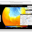
Panoply for Mac 5.4.3 freeware

... on the data, it can draw global longitude-latitude images or pole-to-pole latitude-vertical images.Panoply is a cross-platform application which plots geo-gridded arrays from netCDF, HDF and GRIB datasets. The utility can also combine two arrays and can project the analysis using more than 100 maps. ...

Author Robert B. Schmunk
Released 2024-06-24
Filesize 36.40 MB
Downloads 775
OS Mac OS X
Installation Instal And Uninstall
Keywords plot raster image, longitude image, pole-to-pole image, raster image, rasterize, raster
Users' rating
(29 rating)
Panoply for MacCADMac OS X
Panoply for Mac - images Freeware Download Notice

Panoply for Mac Free Download - we do not host any Panoply for Mac torrent files or links of Panoply for Mac on rapidshare.com, depositfiles.com, megaupload.com etc. All Panoply for Mac download links are direct Panoply for Mac download from publisher site or their selected mirrors.

Panoply for Mac freeware - The Latest User Reviews
Panoply for Mac freeware - The Latest Versions History
5.4.3 Jun 24, 2024 New Release
5.4.1 Jun 1, 2024 New Release
5.4.0 May 11, 2024 New Release

Most popular CAD freeware downloads

Panoply for Mac

5.4.3 freeware download

... to disk GIF, JPEG, PNG or TIFF bitmap images or as PDF or PostScript graphics files. Export ... video or as a collection of invididual frame images. Explore remote THREDDS and OpenDAP catalogs and open ...

Portable MicroDicom x64

2024.2 freeware download

... application for primary processing and preservation of medical images in DICOM format. It is equipped with most common tools for manipulation of DICOM images and it has an intuitive user interface. ...

MicroDicom x64

2024.2 freeware download

... application for primary processing and preservation of medical images in DICOM format. It is equipped with most common tools for manipulation of DICOM images and it has an intuitive user interface. ...

Digimizer

6.4.0 freeware download

... BMP, PNG, WMF, EMF and DICOM files. Images can be rotated, flipped or straightened. Image brightness ... image, but can also include measurements of several images. Open & save Measurements list Print Measurements ...

ShareCAD

2.0 freeware download

... installing any additional software; - zoom and rotate images, change display modes and use measuring tools; - print drawings; - create temporary links that will ...

TNTmips

20240404 freeware download

TNTmips software is a complete Geographic Information System (GIS) that lets you work with virtually any type of geospatial data including imagery, terrain surfaces, and map ...

Elshayal Smart

23.02 freeware download

... save GPS route and View and Rectify Raster Images gif, jpg, bmp and Edit shape files, build new layer, add existing layer, remove layers, swap ...

TNTmips for Mac OS X

20240111 freeware download

TNTmips for Mac is a complete Geographic Information System (GIS) that lets you work with virtually any type of geospatial data including imagery, terrain surfaces, and ...

3D Home Design by Livecad

3.1 freeware download

... straight and corner bathtubs, accessories etc. - Calculate images using ray tracing - Global Illumination for a hyper-realistic photo quality rendering - Control the type ...

MagicPlot Student for Mac OS X

2.9.3 freeware download

... scaling * Visual nonlinear curve fitting * Vector images export and copying * Automatic formula recalculation on data change * English ligatures support in labels ...