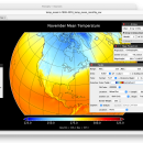
Panoply for Mac 5.4.3 freeware

Panoply for Mac is an utility that enable user to plot ... on the data, it can draw global longitude-latitude images or pole-to-pole latitude-vertical images.Panoply is a cross-platform application which plots geo-gridded arrays from netCDF, HDF and GRIB datasets. The utility can also combine two arrays and can project the analysis using more than 100 maps. ...

Author Robert B. Schmunk
Released 2024-06-24
Filesize 36.40 MB
Downloads 732
OS Mac OS X
Installation Instal And Uninstall
Keywords plot raster image, longitude image, pole-to-pole image, raster image, rasterize, raster
Users' rating
(24 rating)
Panoply for MacCADMac OS X
Panoply for Mac - images on mac Freeware Download Notice

Panoply for Mac Free Download - we do not host any Panoply for Mac torrent files or links of Panoply for Mac on rapidshare.com, depositfiles.com, megaupload.com etc. All Panoply for Mac download links are direct Panoply for Mac download from publisher site or their selected mirrors.

Panoply for Mac freeware - The Latest User Reviews
Panoply for Mac freeware - The Latest Versions History
5.4.3 Jun 24, 2024 New Release
5.4.1 Jun 1, 2024 New Release
5.4.0 May 11, 2024 New Release

Most popular CAD freeware downloads

Panoply for Mac

5.4.3 freeware download

Panoply for Mac is a cross-platform application which plots geo-gridded arrays ... to disk GIF, JPEG, PNG or TIFF bitmap images or as PDF or PostScript graphics files. Export ...

Gwyddion for Linux

2.66 freeware download

... easier. Gwyddion works on GNU/Linux, Microsoft Windows, Mac OS X and FreeBSD operating systems on common ... axes scale callibration · merging and immersion of images · tip modelling, blind estimation, dilation and erosion ...

JMARS

3.1.5 freeware download

... use and open-sourced, and is actively supported on Mac, Windows, Linux, and Solaris. MARS can do ... or night), plot footprints and render remote sensing images from orbiters. * Correlate mineral compositions with topographic ...

5 freeware award

JMARS for Windows

3.1.5 freeware download

... use and open-sourced, and is actively supported on Mac, Windows, Linux, and Solaris. MARS can do ... or night), plot footprints and render remote sensing images from orbiters. * Correlate mineral compositions with topographic ...

MagicPlot Student for Mac OS X

2.9.3 freeware download

... scaling * Visual nonlinear curve fitting * Vector images export and copying * Automatic formula recalculation on data change * English ligatures support in labels ...

Gwyddion

2.66 freeware download

... easier. Gwyddion works on GNU/Linux, Microsoft Windows, Mac OS X and FreeBSD operating systems on common ... axes scale callibration · merging and immersion of images · tip modelling, blind estimation, dilation and erosion ...

p3d for Linux, Mac OS X

2.2.4.1 freeware download

... hundred to several thousand. p3d can combine several images (exposures) into one image, can extract spectra using three different methods, does full error propagation through ...

Energy2D

2.6 freeware download

... browser on Windows (XP, Vista, and Windows 7), Mac OS X, and Linux, provided that Java (Version ... comparison of the results of Energy2D simulations with images from infrared (IR) thermography for a simple house. ...

Energy2D for Mac OS X

2.6 freeware download

... browser on Windows (XP, Vista, and Windows 7), Mac OS X, and Linux, provided that Java (Version ... comparison of the results of Energy2D simulations with images from infrared (IR) thermography for a simple house. ...

TNTmips for Mac OS X

20240111 freeware download

TNTmips for Mac is a complete Geographic Information System (GIS) that lets you work with virtually any type of geospatial data including imagery, terrain surfaces, ...