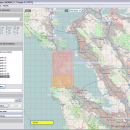
Mobile Atlas Creator 2.2.1 freeware

Mobile Atlas Creator is a small, simple, Java based application specially designed to help you create atlases for TrekBuddy. Basically this software will create offline atlases for GPS handhelds and cell phone applications like TrekBuddy, AndNav and other Android and WindowsCE based applications. ...

Author Fredrik Moller
Released 2021-06-02
Filesize 15.00 MB
Downloads 2251
OS Windows XP, Windows Vista, Windows Vista x64, Windows 7, Windows 7 x64, Windows 8, Windows 8 x64, Windows 10, Windows 10 x64, Linux
Installation Instal And Uninstall
Keywords create atlas, generate atlas, atlas creator, generator, generate, create
Users' rating
(27 rating)
Mobile Atlas CreatorCADWindows XP, Windows Vista, Windows Vista x64, Windows 7, Windows 7 x64, Windows 8, Windows 8 x64, Windows 10, Windows 10 x64, Linux
Mobile Atlas Creator - image tool Freeware Download Notice

Mobile Atlas Creator Free Download - we do not host any Mobile Atlas Creator torrent files or links of Mobile Atlas Creator on rapidshare.com, depositfiles.com, megaupload.com etc. All Mobile Atlas Creator download links are direct Mobile Atlas Creator download from publisher site or their selected mirrors.

Mobile Atlas Creator freeware - The Latest User Reviews
Mobile Atlas Creator freeware - The Latest Versions History
2.2.1 Jun 2, 2021 New Release
2.1.3 Rev 24 Apr 14, 2020 New Release Minimum supported Java version increased to Java 8 (1.8)
"mapFile must not be null" error when creating an atlas
Save settings to settings.xml in UTF-8 format (fix for #324)
Map creation error with JPEG (Garmin Custom and others) (fix for #326)
2.1.2 Rev 24 Oct 11, 2019 New Release Minimum supported Java version increased to Java 8 (1.8)
"mapFile must not be null" error when creating an atlas
Save settings to settings.xml in UTF-8 format (fix for #324)
Map creation error with JPEG (Garmin Custom and others) (fix for #326)

Most popular CAD freeware downloads

Portable MicroDicom x64

2024.2 freeware download

... application for primary processing and preservation of medical images in DICOM format. It is equipped with most common tools for manipulation of DICOM images and it has ...

MicroDicom x64

2024.2 freeware download

... application for primary processing and preservation of medical images in DICOM format. It is equipped with most common tools for manipulation of DICOM images and it has ...

Melanie Viewer

7.0.7 freeware download

... SIB is to provide a wealth of useful tools to the international scientific community. The Melanie Viewer 7.0 is one of these tools. This Viewer is made available free of charge ...

TNTmips

20240404 freeware download

... with virtually any type of geospatial data including imagery, terrain surfaces, and map data with associated database attributes. It provides all the tools you need to view, create, edit, georeference, interpret, ...

Spirograph

1.0.2.1 freeware download

... that was specially designed to offer you a tool to simulate a Spirograph toy. This ... not possible using the real toy) · See image creation as animation · Export the created patterns ...

JMARS for Windows

3.1.5 freeware download

... Flight Facility to provide mission planning and data-analysis tools to NASA's orbiters, instrument team members, students of ... terabyte of NASA orbiter data, and has basic image and vector processing features to conveniently compare, plot, ...

MagicPlot Student for Mac OS X

2.9.3 freeware download

MagicPlot is a handy tool for scientific and engineer data processing, plotting and ... scaling * Visual nonlinear curve fitting * Vector images export and copying * Automatic formula recalculation on ...

pCon.planner

8.9.0.100 freeware download

... Optimal handling of data - Realistic, on-demand product images with OSPRay - Sharing of pCon.planner panoramas directly ... Setting back-up folder for plans - OSPRay: Improved Image Quality - Rendering Animations with OSPRay - Exporting ...

Mobile Atlas Creator

2.2.1 freeware download

... maps can be exported as one large PNG image with calibration MAP file for OziExplorer. As source ... OSMtracker (Windows Mobile/Pocket PC) OziExplorer (single 24bit PNG image with calibration (MAP) file PathAway (Windows Mobile) RMaps ...

JMARS

3.1.5 freeware download

... Flight Facility to provide mission planning and data-analysis tools to NASA's orbiters, instrument team members, students of ... terabyte of NASA orbiter data, and has basic image and vector processing features to conveniently compare, plot, ...

5 freeware award