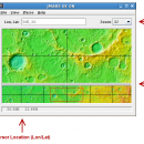
JMARS 3.1.5 freeware

... Flight Facility to provide mission planning and data-analysis tools to NASA's orbiters, instrument team members, students of all ages, and the general public. ...

Author Arizona State University
Released 2014-08-12
Filesize 50.00 MB
Downloads 706
OS Linux, Mac OS X
Installation Instal And Uninstall
Keywords mission analysis, geospatial information, GIS analysis, mission, analysis, GIS
Users' rating
(10 rating)
JMARSCADLinux, Mac OS X
Our rating 5 freeware award
JMARS - image tool Freeware Download Notice

JMARS Free Download - we do not host any JMARS torrent files or links of JMARS on rapidshare.com, depositfiles.com, megaupload.com etc. All JMARS download links are direct JMARS download from publisher site or their selected mirrors.

JMARS freeware - The Latest User Reviews
JMARS freeware - The Latest Versions History
3.1.5 Aug 12, 2014 New Release - In JMARS, locate the "Options" tab at the top of the screen, click it
- Click "Check for Updates"
3.0.4 Jun 7, 2013 New Release - minor change that will allow users to use Body->reset layers to reset layers to JMARS default/startup state
- minor bug fix in the interaction of the Main view and Panner views
- accuracy of crater layer settings improved when saving crater layers as part of a saved session
- more graceful error handling when loading a saved session
- removed the ESRI option from the list for loading/saving in the shape layer. The Geo tools ESRI option is the replacement
- a fix for a drawing issue in the TES layer on Mac OS X running Java 7
- lower right corner coordinates added to the high resolution export tool including new UI functionality for setting export height and width
- update to how image corners (lat/lon) are specified in high resolution export
- added CSV export and look and feel changes to the Investigate tool
- improved communication between the Stamp Layer and backend databases
- Add Layer UI look and feel improvements
- ease of use changes to crater counting layer for small bodies
1.25 Aug 22, 2011 New Release General:
· The Look and Feel of JMARS should now be more consistent with the platform it is on.

Map Layer:
· Added a "View Citations" button to the source section of the Map Layer focus panel.
· Custom Map Upload fix to prevent

Most popular CAD freeware downloads

Portable MicroDicom

2024.2 freeware download

... application for primary processing and preservation of medical images in DICOM format. It is equipped with most common tools for manipulation of DICOM images and it has ...

QFitsView

8.6 freeware download

... data visualization software that has become an indispensable tool for astronomers and astrophysicists worldwide. Designed to handle ... core, DS9 excels in displaying and analyzing astronomical images, supporting a wide array of file formats including ...

Techne CAD/CAM

1.0.31.0 RC freeware download

... that when the design/layout phase is completed the toolpath generation can occur automatically. What is 2.5D? ... formats. Features: Multithreaded 3D part and toolpath preview GCode toolpath generation ShopBot toolpath generation Text ...

MicroDicom

2024.2 freeware download

... application for primary processing and preservation of medical images in DICOM format. It is equipped with most common tools for manipulation of DICOM images and it has ...

Circuit Diagram

3.1.0 B3 freeware download

... diagrams and allows them to be exported as images. Ideal for use in coursework, you no longer have to use image editing programs to paste components together. Features: ...

ZeGrapher for Mac OS X

2.0.0 freeware download

... an easy-to-use mathematical function plotting application. This handy tool can be specially suitable for high school students ... choose scale, graph size, ..., in centimeters Export: image or PDF Draw derivatives and anti-derivatives. ...

GpsTools Studio

2.3.1 build 227 freeware download

GpsTools Studio is a useful tool for the GpsGate Server users that want to ... you to import a map from a popular image file and to export it to a compatible ...

VEGA ZZ

3.2.3.28 freeware download

... representations can be mixed thanks to the selection tool. Atom labels (atom name, element, atom type, ... PDBQT multi-model formats. Snapshot, hardware and software image rendering with the capability to create images bigger ...

SeiSee

2.22.6 freeware download

... variable area, variable density, color) - scaling seismic image, gain control, axes labeling setup - plots seismic to printer (plotter) - exports the image in Windows Bitmap (.bmp) and PostScript formats. - ...

TNTmips

20240404 freeware download

... with virtually any type of geospatial data including imagery, terrain surfaces, and map data with associated database attributes. It provides all the tools you need to view, create, edit, georeference, interpret, ...