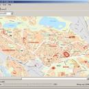
GpsTools Studio 2.3.1 build 227 freeware

GpsTools Studio is a useful tool for the GpsGate Server users that want to ... you to import a map from a popular image file and to export it to a compatible format. ...

Author Franson Technology
Released 2012-11-21
Filesize 3.80 MB
Downloads 405
OS Windows XP, Windows Vista, Windows Vista x64, Windows 7, Windows 7 x64, Windows 8, Windows 8 x64, Windows 10, Windows 10 x64
Installation Instal And Uninstall
Keywords create map, import GpsGate map, scale image, map, creator, create
Users' rating
(12 rating)
GpsTools StudioCADWindows XP, Windows Vista, Windows Vista x64, Windows 7, Windows 7 x64, Windows 8, Windows 8 x64, Windows 10, Windows 10 x64
GpsTools Studio - image tool Freeware Download Notice

GpsTools Studio Free Download - we do not host any GpsTools Studio torrent files or links of GpsTools Studio on rapidshare.com, depositfiles.com, megaupload.com etc. All GpsTools Studio download links are direct GpsTools Studio download from publisher site or their selected mirrors.

GpsTools Studio freeware - The Latest User Reviews
GpsTools Studio freeware - The Latest Versions History
2.3.1 build Nov 21, 2012 New Release

Most popular CAD freeware downloads

Portable MicroDicom

2024.2 freeware download

... application for primary processing and preservation of medical images in DICOM format. It is equipped with most common tools for manipulation of DICOM images and it has ...

Engauge Digitizer for Windows

12.0 freeware download

... This open source, digitizing software converts an image file showing a graph or map, into numbers. The image file can come from a scanner, digital camera ...

5 freeware award

Techne CAD/CAM x64

1.0.31.0 RC freeware download

... that when the design/layout phase is completed the toolpath generation can occur automatically. What is 2.5D? ... formats. Features: Multithreaded 3D part and toolpath preview GCode toolpath generation ShopBot toolpath generation Text ...

MagicPlot Student for Mac OS X

2.9.3 freeware download

MagicPlot is a handy tool for scientific and engineer data processing, plotting and ... scaling * Visual nonlinear curve fitting * Vector images export and copying * Automatic formula recalculation on ...

pCon.planner

8.9.0.100 freeware download

... Optimal handling of data - Realistic, on-demand product images with OSPRay - Sharing of pCon.planner panoramas directly ... Setting back-up folder for plans - OSPRay: Improved Image Quality - Rendering Animations with OSPRay - Exporting ...

Mobile Atlas Creator

2.2.1 freeware download

... maps can be exported as one large PNG image with calibration MAP file for OziExplorer. As source ... OSMtracker (Windows Mobile/Pocket PC) OziExplorer (single 24bit PNG image with calibration (MAP) file PathAway (Windows Mobile) RMaps ...

Mobile Atlas Creator for Mac OS X

2.2.1 freeware download

... maps can be exported as one large PNG image with calibration MAP file for OziExplorer. As source ... OSMtracker (Windows Mobile/Pocket PC) OziExplorer (single 24bit PNG image with calibration (MAP) file PathAway (Windows Mobile) RMaps ...

MuniWin

2.1.13 freeware download

... which offers the complete solution for reduction of images carried out by CCD camera, intended on a ... up with the Munipack package, the programs and tools have the same name, but in difference to ...

Energy2D

2.6 freeware download

... radiation. Students can use it as an inquiry tool to explore and investigate heat and mass flows ... comparison of the results of Energy2D simulations with images from infrared (IR) thermography for a simple house. ...

Engauge Digitizer for Mac OS X

12.0 freeware download

... This open source, digitizing software converts an image file showing a graph or map, into numbers. The image file can come from a scanner, digital camera ...

5 freeware award