Panoply for Mac 5.4.3 freeware

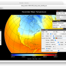
... an utility that enable user to plot raster image. Depending on the data, it can draw global longitude-latitude images or pole-to-pole latitude-vertical images.Panoply is a cross-platform application which plots geo-gridded arrays from netCDF, HDF and GRIB datasets. The utility can also combine two arrays and can project the analysis using more than 100 maps. ...

Author Robert B. Schmunk
Released 2024-06-24
Filesize 36.40 MB
Downloads 730
OS Mac OS X
Installation Instal And Uninstall
Keywords plot raster image, longitude image, pole-to-pole image, raster image, rasterize, raster
Users' rating
(24 rating)
Panoply for MacCADMac OS X
Panoply for Mac - image scale Freeware Download Notice

Panoply for Mac Free Download - we do not host any Panoply for Mac torrent files or links of Panoply for Mac on rapidshare.com, depositfiles.com, megaupload.com etc. All Panoply for Mac download links are direct Panoply for Mac download from publisher site or their selected mirrors.

Panoply for Mac freeware - The Latest User Reviews
Panoply for Mac freeware - The Latest Versions History
5.4.3 Jun 24, 2024 New Release
5.4.1 Jun 1, 2024 New Release
5.4.0 May 11, 2024 New Release

Most popular CAD freeware downloads

Panoply for Mac

5.4.3 freeware download

... browse between datasets and catalogues, to adjust the scale range, to customize labels, vectors, to overlay masks, ... Use any of numerous color tables for the scale colorbar, or apply your own custom ACT, CPT, ...

Gwyddion for Linux

2.66 freeware download

... generally used for any other height field and image analysis, for instance for analysis of profilometry data ... dimension determination · force-distance curve fitting · axes scale callibration · merging and immersion of images · ...

ZeGrapher for Mac OS X

2.0.0 freeware download

... parameter. Easy navigation on the graph: move, zoom, scale... Print: choose scale, graph size, ..., in centimeters Export: image or PDF Draw derivatives and anti-derivatives. ...

GpsTools Studio

2.3.1 build 227 freeware download

... you to import a map from a popular image file and to export it to a compatible format. The user can easily scale the map image by using the wizard available ...

Gwyddion

2.66 freeware download

... generally used for any other height field and image analysis, for instance for analysis of profilometry data ... dimension determination · force-distance curve fitting · axes scale callibration · merging and immersion of images · ...

ZeGrapher

2.0.0 freeware download

... parameter. Easy navigation on the graph: move, zoom, scale... Print: choose scale, graph size, ..., in centimeters Export: image or PDF Draw derivatives and anti-derivatives. ...

ZeGrapher for Linux

2.0.0 freeware download

... parameter. Easy navigation on the graph: move, zoom, scale... Print: choose scale, graph size, ..., in centimeters Export: image or PDF Draw derivatives and anti-derivatives. ...

BabaCAD

2.0.0 freeware download

... circle, arc, hatch with patterns, text, block, dimension, image Fast access to blocks using Block Explorer ... well with lwpolylines with bulges) Plot with scale, layout and multiple viewport support Use different ...

VEGA ZZ

3.2.3.28 freeware download

... managed with mouse, joystick and dials (rotation, translation, scale and animation). 3D interactive monitors calculated in ... PDBQT multi-model formats. Snapshot, hardware and software image rendering with the capability to create images bigger ...

Br3D

1.3 freeware download

... layer, line type options Save As Save As Image Saves current view as image Object snap Annotation Coordinates Distance Memo Measure Measure ... Text, Polyline, Spline, Insert Model, Insert Block, Insert Image Draw 3D Box, Cylinder, Cone, Torus, Sphere Terrain ...