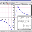
Engauge Digitizer for Mac OS X 12.0 freeware

... /> This open source, digitizing software converts an image file showing a graph or map, into numbers. The image file can come from a scanner, digital camera ... />
The process starts with an image file containing a graph or map. The final result is digitized data that can be used by other tools such as Microsoft Excel. ...

Author Mark Mitchell
Released 2019-08-19
Filesize 10.10 MB
Downloads 892
OS Mac OS X
Installation Instal And Uninstall
Keywords digitize image, image to number, process image, digitize, convert, digitizer
Users' rating
(24 rating)
Engauge Digitizer for Mac OS XCADMac OS X
Our rating 5 freeware award
Engauge Digitizer for Mac OS X - image formats Freeware Download Notice

Engauge Digitizer for Mac OS X Free Download - we do not host any Engauge Digitizer for Mac OS X torrent files or links of Engauge Digitizer for Mac OS X on rapidshare.com, depositfiles.com, megaupload.com etc. All Engauge Digitizer for Mac OS X download links are direct Engauge Digitizer for Mac OS X download from publisher site or their selected mirrors.

Engauge Digitizer for Mac OS X freeware - The Latest User Reviews
Engauge Digitizer for Mac OS X freeware - The Latest Versions History
12.0 Aug 19, 2019 New Release New hourglass and triangle point types (#346)
Fix data export for log scale data when step factor is less than one (#345)
10.4 Oct 11, 2017 New Release Show warning message when grid line maximum is exceed (#244)
CSV export files have double quotes on fields with internal commas (#243)
Status bar shows all of text for right-to-left languages (#240)
5.1 Dec 24, 2012 New Release Fix for broken point matching, and control of the x/theta axis label.

Most popular CAD freeware downloads

Portable MicroDicom x64

2024.2 freeware download

... application for primary processing and preservation of medical images in DICOM format. It is equipped with most common tools for manipulation of DICOM images and it has an intuitive user interface. ...

MicroDicom x64

2024.2 freeware download

... application for primary processing and preservation of medical images in DICOM format. It is equipped with most common tools for manipulation of DICOM images and it has an intuitive user interface. ...

Digimizer

6.4.0 freeware download

Digimizer is an easy-to-use and flexible image analysis software package that allows precise manual measurements ... Pictures may be X-rays, micrographs, etc. Supported file formats are JPG, GIF, TIFF, BMP, PNG, WMF, EMF ...

TNTmips

20240404 freeware download

... with virtually any type of geospatial data including imagery, terrain surfaces, and map data with associated database ... Include layers in a wide variety of external formats without importing. Overlay your geodata on Bing Maps ...

Engauge Digitizer for Windows

12.0 freeware download

... This open source, digitizing software converts an image file showing a graph or map, into numbers. The image file can come from a scanner, digital camera ...

5 freeware award

Engauge Digitizer for Linux

12.0 freeware download

... This open source, digitizing software converts an image file showing a graph or map, into numbers. The image file can come from a scanner, digital camera ...

SeiSee

2.22.6 freeware download

... (2,4 bytes) and IBM float (4 bytes) sample formats - nonstandard integer(1 byte), float IEEE (4 bytes) sample formats[1] - CGG Geovecteur disk SEG-Y format (.dat) (stg1) ...

JMARS for Windows

3.1.5 freeware download

... terabyte of NASA orbiter data, and has basic image and vector processing features to conveniently compare, plot, ... and overlay them into a single, registered multilayer image. * Make topographic profiles, extract surface temperatures (day ...

Portable MicroDicom

2024.2 freeware download

... application for primary processing and preservation of medical images in DICOM format. It is equipped with most common tools for manipulation of DICOM images and it has an intuitive user interface. ...

TNTmips for Mac OS X

20240111 freeware download

... with virtually any type of geospatial data including imagery, terrain surfaces, and map data with associated database ... Include layers in a wide variety of external formats without importing. Overlay your geodata on Bing Maps ...