- Freeware
- - Graphic Apps
- - CAD
- - JMARS
JMARS 3.1.5 freeware
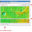
... an acronym that stands for Java Mission-planning and Analysis for Remote Sensing. It is a geospatial information system (GIS) developed by ASU's Mars Space Flight Facility to provide mission planning and data-analysis tools to NASA's orbiters, instrument team members, students of all ages, and the general public. ...
| Author | Arizona State University |
| Released | 2014-08-12 |
| Filesize | 50.00 MB |
| Downloads | 732 |
| OS | Linux, Mac OS X |
| Installation | Instal And Uninstall |
| Keywords | mission analysis, geospatial information, GIS analysis, mission, analysis, GIS |
| Users' rating (21 rating) |
|
| Our rating |

|
JMARS Free Download - we do not host any JMARS torrent files or links of JMARS on rapidshare.com, depositfiles.com, megaupload.com etc. All JMARS download links are direct JMARS download from publisher site or their selected mirrors.
| 3.1.5 | Aug 12, 2014 | New Release | - In JMARS, locate the "Options" tab at the top of the screen, click it - Click "Check for Updates" |
| 3.0.4 | Jun 7, 2013 | New Release | - minor change that will allow users to use Body->reset layers to reset layers to JMARS default/startup state - minor bug fix in the interaction of the Main view and Panner views - accuracy of crater layer settings improved when saving crater layers as part of a saved session - more graceful error handling when loading a saved session - removed the ESRI option from the list for loading/saving in the shape layer. The Geo tools ESRI option is the replacement - a fix for a drawing issue in the TES layer on Mac OS X running Java 7 - lower right corner coordinates added to the high resolution export tool including new UI functionality for setting export height and width - update to how image corners (lat/lon) are specified in high resolution export - added CSV export and look and feel changes to the Investigate tool - improved communication between the Stamp Layer and backend databases - Add Layer UI look and feel improvements - ease of use changes to crater counting layer for small bodies |
| 1.25 | Aug 22, 2011 | New Release | General: · The Look and Feel of JMARS should now be more consistent with the platform it is on. Map Layer: · Added a "View Citations" button to the source section of the Map Layer focus panel. · Custom Map Upload fix to prevent |


