QGIS for Mac 3.36.1 freeware

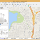
QGIS supports vector, raster, and database formats and lets you browse and create map data on your computer.
QGIS supports many common spatial data formats (e.g. ESRI ShapeFile, geotiff). QGIS supports plugins to do things like display tracks from your GPS.
QGIS aims to be an easy to use GIS, providing common functions and features. The initial goal was to provide a GIS data viewer. ...

Author Gary Sherman
Released 2024-03-26
Filesize 1600.00 MB
Downloads 746
OS Mac OS X
Installation Instal And Uninstall
Keywords geographic information system, map creator, map viewer, GIS, geographic information, create, QGIS for Mac
Users' rating
(24 rating)
QGIS for MacCADMac OS X
QGIS for Mac - identify Freeware Download Notice

QGIS for Mac Free Download - we do not host any QGIS for Mac torrent files or links of QGIS for Mac on rapidshare.com, depositfiles.com, megaupload.com etc. All QGIS for Mac download links are direct QGIS for Mac download from publisher site or their selected mirrors.

QGIS for Mac freeware - The Latest User Reviews
QGIS for Mac freeware - The Latest Versions History
3.36.1 Mar 26, 2024 New Release
3.36.2 Apr 25, 2024 New Release
3.36.1 Mar 26, 2024 New Release

Most popular CAD freeware downloads

QGIS for Mac

3.36.1 freeware download

... projection of vector layers · Map composer · Identify features · Display attribute table · Select features · Label features · Persistent selections · Save ...

ANTz for Mac

2018-07-25-0251 freeware download

... visual environment enables a more efficient mechanism for identifying patterns and relationships. Data fields are mapped to ... color, size and texture enable the user to identify key patterns. The ultimate goal is to close ...

JMARS

3.1.5 freeware download

... you can also use JMARS to plan observations, identify regions of interest, review previously acquired data, and examine datasets from past missions. For more ...

5 freeware award

sRNA Workbench

4.5.1 freeware download

... sRNA datasets from both plants and animals to identify interesting landmarks (such as detection of novel miRNA ... representation of sRNAs and user-imported genomic features. PAREsnip2: Identify miRNA targets evidenced through the degradome ...

enCIFer for Mac OS X

1.4 freeware download

... single or multi-block CIFs allowing you to: Identify and correct syntax/format violations Safely edit information to your CIF without corrupting the strict syntax, for ...

enCIFer for Linux

1.4 freeware download

... single or multi-block CIFs allowing you to: Identify and correct syntax/format violations Safely edit information to your CIF without corrupting the strict syntax, for ...

QGIS

3.36.1 freeware download

... projection of vector layers · Map composer · Identify features · Display attribute table · Select features · Label features · Persistent selections · Save ...

QGIS for Linux

3.36.1 freeware download

... projection of vector layers · Map composer · Identify features · Display attribute table · Select features · Label features · Persistent selections · Save ...

ANTz

2019-03-18 freeware download

... visual environment enables a more efficient mechanism for identifying patterns and relationships. Data fields are mapped to ... color, size and texture enable the user to identify key patterns. The ultimate goal is to close ...

ANTz for Linux

2017-01-08 freeware download

... visual environment enables a more efficient mechanism for identifying patterns and relationships. Data fields are mapped to ... color, size and texture enable the user to identify key patterns. The ultimate goal is to close ...