MicroCity 1.8 freeware
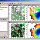
MicroCity is a framework for spatial analysis and simulation. It is lightweight, fast, portable, extendable and user friendly. Users can easily operate large GIS and Grid data and perform Spatial, Fractal, Network analysis and simulation. ...
| Author | Sourceforge |
| Released | 2018-03-14 |
| Filesize | 6.83 MB |
| Downloads | 1176 |
| OS | Windows XP, Windows Vista, Windows Vista x64, Windows 7, Windows 7 x64, Windows 8, Windows 8 x64, Windows 10, Windows 10 x64 |
| Installation | Instal And Uninstall |
| Keywords | spatial analysis, spatial simulation, fractal analysis, analysis, analyze, analyzer |
| Users' rating (14 rating) |
MicroCity Free Download - we do not host any MicroCity torrent files or links of MicroCity on rapidshare.com, depositfiles.com, megaupload.com etc. All MicroCity download links are direct MicroCity download from publisher site or their selected mirrors.
| 1.8 | Mar 14, 2018 | New Release | |
| 1.29 | Apr 9, 2013 | New Release | |
| 1.15 | Sep 16, 2010 | New Release |

