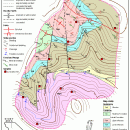
TNTatlas for Mac OS X 2024 B20240508 freeware

... and geospatial data — from a single geodata file to complex map layouts prepared using TNTmips. TNTatlas ... massive sized geodata and will directly display numerous file formats including shapefiles, GeoTIFF, JP2, PNG, MrSID, DXF, and DWG. ...

Author MicroImages, Inc.
Released 2024-05-08
Filesize 87.90 MB
Downloads 785
OS Mac OS X
Installation Instal And Uninstall
Keywords geospatial viewer, view atlas, visualize geospatial data, atlas, map, viewer
Users' rating
(53 rating)
TNTatlas for Mac OS XCADMac OS X
TNTatlas for Mac OS X - help file Freeware Download Notice

TNTatlas for Mac OS X Free Download - we do not host any TNTatlas for Mac OS X torrent files or links of TNTatlas for Mac OS X on rapidshare.com, depositfiles.com, megaupload.com etc. All TNTatlas for Mac OS X download links are direct TNTatlas for Mac OS X download from publisher site or their selected mirrors.

TNTatlas for Mac OS X freeware - The Latest User Reviews
TNTatlas for Mac OS X freeware - The Latest Versions History
2024 B202405 May 8, 2024 New Release
2023 B202303 Mar 23, 2023 New Release
2022 B202212 Dec 7, 2022 New Release

Most popular CAD freeware downloads

FilterPro Desktop

3.1.0.23446 freeware download

... filters now accounts for passband ripple Supports design file migration from FilterPro v2 so that designs created ... reports containing all design data and schematics to help speed time to market. Supports Bessell, Butterworth, Chebychev, ...

TNTatlas

2024 B20240606 freeware download

... and geospatial data — from a single geodata file to complex map layouts prepared using TNTmips. TNTatlas ... massive sized geodata and will directly display numerous file formats including shapefiles, GeoTIFF, JP2, PNG, MrSID, DXF, ...

Gephi for Mac OS X

0.10.1 freeware download

... to reveal hidden properties. The goal is to help data analysts to make hypothesis, intuitively discover patterns, ... component. · Import temporal graph with the GEXF file format · Graph streaming ready Create cartography: ...

MicroDicom

2024.2 freeware download

... *.bmp, *.gif, etc) Open and save DICOM directory files Display of patient list from DICOMDIR Display images ... images to the most common picture formats, movie file format(.avi) and clipboard Brightness/contrast control Zooming and panning ...

MicroDicom x64

2024.2 freeware download

... *.bmp, *.gif, etc) Open and save DICOM directory files Display of patient list from DICOMDIR Display images ... images to the most common picture formats, movie file format(.avi) and clipboard Brightness/contrast control Zooming and panning ...

OpenDCL Studio

9.1.5.2 freeware download

OpenDCL is a handy, easy-to-use and accessible insturment that is specially designed for AutoLISP programmers that want to replace AutoCAD's limited DCL. They can replace ...

Engauge Digitizer for Mac OS X

12.0 freeware download

... This open source, digitizing software converts an image file showing a graph or map, into numbers. The image file can come from a scanner, digital camera or ...

5 freeware award

Model Air Design

2.4 freeware download

... is a cross-platform software utility built specifically for helping users create 3D-model aircrafts. While other dedicated CAD ... it does not generate line drawings that would help in creating airplane model plans. However, it can ...

Gephi

0.10.1 freeware download

... to reveal hidden properties. The goal is to help data analysts to make hypothesis, intuitively discover patterns, ... component. · Import temporal graph with the GEXF file format · Graph streaming ready Create cartography: ...

Gephi for Linux

0.10.1 freeware download

... to reveal hidden properties. The goal is to help data analysts to make hypothesis, intuitively discover patterns, ... component. · Import temporal graph with the GEXF file format · Graph streaming ready Create cartography: ...