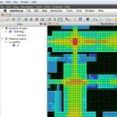
UCL Depthmap 0.8.0 freeware

Depthmap is a single software platform to perform a set of spatial network analyses designed to understand social processes within the built environment. It works at a variety of scales from building through small urban to whole cities or states. ...

Author University College London
Released 2020-11-08
Filesize 35.10 MB
Downloads 1356
OS Windows XP, Windows Vista, Windows Vista x64, Windows 7, Windows 7 x64, Windows 8, Windows 8 x64, Windows 10, Windows 10 x64, Windows 11
Installation Instal And Uninstall
Keywords urban environment, urban map, spatial network analysis, environment, map, analysis
Users' rating
(19 rating)
UCL DepthmapCADWindows XP, Windows Vista, Windows Vista x64, Windows 7, Windows 7 x64, Windows 8, Windows 8 x64, Windows 10, Windows 10 x64, Windows 11
UCL Depthmap - grid Freeware Download Notice

UCL Depthmap Free Download - we do not host any UCL Depthmap torrent files or links of UCL Depthmap on rapidshare.com, depositfiles.com, megaupload.com etc. All UCL Depthmap download links are direct UCL Depthmap download from publisher site or their selected mirrors.

UCL Depthmap freeware - The Latest User Reviews
UCL Depthmap freeware - The Latest Versions History
0.8.0 Nov 8, 2020 New Release General:
Allow for pushing values from shapemaps (axial maps, segment maps) to VGA
Fix VGA map connections export
Make drawing to segment conversion faster
Test and fix shape removal for axial and data maps
Allow pushing the Ref or Key value to another layer
Fix MIF/MID import (allow for empty columns, PR #369)
Fix diagonal line handling on VGA map fill (PR #326, thanks Piotr Piastucki!)
Change C++ standard to 17
Graphical User Interface (GUI):
Highlight shapes and pixels on hover (can be disabled in the settings)
Allow inserting any number in the table (PR #356)
Fix a case where the app would crash with multiple unlinking in VGA (PR #328)
Fix convex map hover and selection (PR #368)
Allow generating multiple isovists by importing a CSV file
Fix a case where VGA progress bar would end, but analysis would still be going (PR #323)
0.7.0 Jun 7, 2019 New Release
0.30 Sep 18, 2014 New Release

Most popular CAD freeware downloads

Techne CAD/CAM

1.0.31.0 RC freeware download

... or mirror designs Manually trace over bitmap image Grid layout with snap to line option ...

Gmsh for Mac OS X

4.13.1 freeware download

Gmsh is an automatic 3D finite element grid generator (primarily Delaunay) with a build-in CAD engine and post-processor. Its design goal is to provide a ...

UCL Depthmap

0.8.0 freeware download

... on), or it can further join a dense grid of isovists into a visibility graph of intervisible points (with graphs of up to about 1000000 ...

Gmsh for Linux

4.13.1 freeware download

Gmsh is an automatic 3D finite element grid generator (primarily Delaunay) with a build-in CAD engine and post-processor. Its design goal is to provide a ...

Multiwfn

3.7 freeware download

... spatial scope, data can be exported to Gaussian-type grid file (.cub) and can be viewed in terms of iso surface. Setting up grid is very flexible and convenient. ยท For property ...

Engauge Digitizer for Windows

12.0 freeware download

... point plots * Automatic axes matching * Automatic grid line removal for improved curve tracing * Handles ... * Image processing tools highlight data by removing grid lines and backgrounds * Status bar suggestions guide ...

5 freeware award

Engauge Digitizer for Mac OS X

12.0 freeware download

... point plots * Automatic axes matching * Automatic grid line removal for improved curve tracing * Handles ... * Image processing tools highlight data by removing grid lines and backgrounds * Status bar suggestions guide ...

5 freeware award

Engauge Digitizer for Linux

12.0 freeware download

... point plots * Automatic axes matching * Automatic grid line removal for improved curve tracing * Handles ... * Image processing tools highlight data by removing grid lines and backgrounds * Status bar suggestions guide ...

Br3D

1.3 freeware download

... Sphere Terrain Create terrain(by layer, by entity, by grid), Up/Down terrain, Coloring terrain(gradation), Create contour Export(LandXML 1.2), Import(LandXML 1.2) Dimension Horizontal, Vertical, Aligned, Radius, Diameter, ...

3D Architecture by LiveCAD

2.1 freeware download

- 2D plans with quotations, grid, 2D/3D simultaneous views - Creation of beams, low ... Easy-to-use drawing-aid tools for high-level precision (help lines, grid) - Real-time 3D rendering so that you can ...