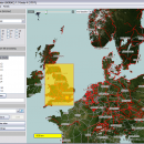
Mobile Atlas Creator for Mac OS X 2.2.1 freeware

... help you create atlases for TrekBuddy. Basically this software will create offline atlases for GPS handhelds and cell phone applications like TrekBuddy, AndNav and other Android and WindowsCE based applications. ...

Author Fredrik Moller
Released 2021-06-02
Filesize 15.00 MB
Downloads 1842
OS Mac OS X
Installation Instal And Uninstall
Keywords create atlas, generate atlas, atlas creator, generator, generate, create
Users' rating
(24 rating)
Mobile Atlas Creator for Mac OS XCADMac OS X
Mobile Atlas Creator for Mac OS X - gps software Freeware Download Notice

Mobile Atlas Creator for Mac OS X Free Download - we do not host any Mobile Atlas Creator for Mac OS X torrent files or links of Mobile Atlas Creator for Mac OS X on rapidshare.com, depositfiles.com, megaupload.com etc. All Mobile Atlas Creator for Mac OS X download links are direct Mobile Atlas Creator for Mac OS X download from publisher site or their selected mirrors.

Mobile Atlas Creator for Mac OS X freeware - The Latest User Reviews
Mobile Atlas Creator for Mac OS X freeware - The Latest Versions History
2.2.1 Jun 2, 2021 New Release
2.1.1 Rev 23 Apr 20, 2015 New Release Changed the MOBAC web site URL (e.g. used for online update):
Map source initialization by atlas creation engine added (fix for #313)
Multi-threading issue with TileImageWriter fixed
2.0.0 Alpha Apr 20, 2015 New Release Mapsforge vector maps library updated to 0.5.1
Mapsforge custom caching implemented (required for correct label rendering)

Most popular CAD freeware downloads

TNTmips for Mac OS X

20240111 freeware download

... reference image; place control points with coordinates from GPS devices. Import and export an unsurpassed number ... and triangulated irregular networks (TINs), respectively. TNTgis software on macOS runs under the XQuartz X Window ...

Mobile Atlas Creator

2.2.1 freeware download

... source (GPL) program which creates offline atlases for GPS handhelds and cell phone applications like TrekBuddy, AndNav ... a large number of different (mobile) applications and GPS handhelds: AFTrack (Symbian) AlpineQuest (Android) AndNav (Android) BackCountry ...

Mobile Atlas Creator for Mac OS X

2.2.1 freeware download

... source (GPL) program which creates offline atlases for GPS handhelds and cell phone applications like TrekBuddy, AndNav ... a large number of different (mobile) applications and GPS handhelds: AFTrack (Symbian) AlpineQuest (Android) AndNav (Android) BackCountry ...

Engauge Digitizer for Windows

12.0 freeware download

Engauge Digitizer - Digitizing software This open source, digitizing software converts an image file showing a graph or ... but you do not have an odometer or GPS unit. However, you do have a map. ...

5 freeware award

Engauge Digitizer for Mac OS X

12.0 freeware download

Engauge Digitizer - Digitizing software This open source, digitizing software converts an image file showing a graph or ... but you do not have an odometer or GPS unit. However, you do have a map. ...

5 freeware award

Engauge Digitizer for Linux

12.0 freeware download

Engauge Digitizer - Digitizing software This open source, digitizing software converts an image file showing a graph or ... but you do not have an odometer or GPS unit. However, you do have a map. ...

TNTmips

20240404 freeware download

TNTmips software is a complete Geographic Information System (GIS) that ... reference image; place control points with coordinates from GPS devices ... Import and export an unsurpassed ...

Elshayal Smart

23.02 freeware download

Elshayal Smart is the first Arabian GIS software that is completely developed by Arabian developers team and independent of any commercial software package. Download Maps from Google Earth, and ...

QGIS

3.36.1 freeware download

... proud to be itself Free and Open Source Software (FOSS). QGIS supports vector, raster, and database ... to do things like display tracks from your GPS. QGIS aims to be an easy to ...

QGIS for Mac

3.36.1 freeware download

... proud to be itself Free and Open Source Software (FOSS). QGIS supports vector, raster, and database ... to do things like display tracks from your GPS. QGIS aims to be an easy to ...