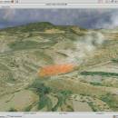
Virtual Terrain Project for Mac OS X and Linux 1.1 110804 freeware

... a synergetic convergence of the fields of CAD, GIS, visual simulation, surveying and remote sensing. VTP gathers information and tracks progress in areas such as procedural scene construction, feature extraction, and rendering algorithms. ...

Author Ben Discoe
Released 2011-09-08
Filesize 2.20 MB
Downloads 377
OS Linux, Mac OS X
Installation Instal And Uninstall
Keywords libraries, demos, data, open source, VirtualTerrain Project, CAD, GIS, VTP
Users' rating
(9 rating)
Virtual Terrain Project for Mac OS X and LinuxCADLinux, Mac OS X
Virtual Terrain Project for Mac OS X and Linux - gis software Freeware Download Notice

Virtual Terrain Project for Mac OS X and Linux Free Download - we do not host any Virtual Terrain Project for Mac OS X and Linux torrent files or links of Virtual Terrain Project for Mac OS X and Linux on rapidshare.com, depositfiles.com, megaupload.com etc. All Virtual Terrain Project for Mac OS X and Linux download links are direct Virtual Terrain Project for Mac OS X and Linux download from publisher site or their selected mirrors.

Virtual Terrain Project for Mac OS X and Linux freeware - The Latest User Reviews
Virtual Terrain Project for Mac OS X and Linux freeware - The Latest Versions History
1.1 110804 Sep 8, 2011 New Release Enviro:
Exposed support for more stereo modes: Horizontal and Vertical split.
Options to enable joystick and spacenavigator, rather than just always using them if present.
Smooth continuous update when making buildings.
Option to constrain building point to right angles. Deter user from making bad points.
Made support for Collada (.dae) more explicit in the UI.
Display the version number in the startup dialog.
Added 'every N meters' option to Contour dialog, making it significantly more useful.
Changed 'Move' mode to use Alt modifier key for up/down, to be consistent.
Fixed issues with: support for elevation grids with non-unit vertical scale; removing layers from a terrain; saving snapshot and high-resolution snapshot; buildings with a Geographic CRS; draping of 2D polylines on terrain with vertical exaggeration.

VTBuilder:
Raw layers: Draw polygon holes as dotted lines to tell them from outer edges.

Most popular CAD freeware downloads

ArcReader

10.5.0 B6491 freeware download

... that was once limited to those with advanced GIS software on their computers. With ArcReader, you can ... ArcGIS maps using ArcReader (.pmf files). Deploy your GIS data to novices and professionals alike. Zoom, pan, ...

Thuban for Mac OS X

1.0.1-3 freeware download

... The FreeGIS Project provides an overview of Free Software GIS projects. Many valuable and highly sophisticated tools exist, ... information. Thuban makes use of several Free GIS Software components and is itself the basis of ...

CARIS Easy View

4.2.13 freeware download

... of file types without the need for specialized software. CARIS Easy View gives users control of ... support for multiple types of files, as various GIS applications save maps and models to a wide ...

QGIS

3.36.1 freeware download

QGIS is a professional GIS application that is built on top of and proud to be itself Free and Open Source Software (FOSS). QGIS supports vector, raster, and database ...

QGIS for Linux

3.36.1 freeware download

QGIS is a professional GIS application that is built on top of and proud to be itself Free and Open Source Software (FOSS). QGIS supports vector, raster, and database ...

Thuban for Windows

1.2.2 freeware download

... The FreeGIS Project provides an overview of Free Software GIS projects. Many valuable and highly sophisticated tools exist, ... information. Thuban makes use of several Free GIS Software components and is itself the basis of ...

Thuban for Linux

1.2.2 freeware download

... The FreeGIS Project provides an overview of Free Software GIS projects. Many valuable and highly sophisticated tools exist, ... information. Thuban makes use of several Free GIS Software components and is itself the basis of ...

TNTmips

20240404 freeware download

TNTmips software is a complete Geographic Information System (GIS) that ... Spatial, DGN, TAB, DXF, DWG ... Full-featured GIS that integrates imagery along with geometric data including ...

Elshayal Smart

23.02 freeware download

Elshayal Smart is the first Arabian GIS software that is completely developed by Arabian developers team and independent of any commercial software package. Download Maps from Google Earth, and ...

QGIS for Mac

3.36.1 freeware download

QGIS is a professional GIS application that is built on top of and proud to be itself Free and Open Source Software (FOSS). QGIS supports vector, raster, and database ...