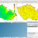
Grass GIS 8.2.0 freeware
GRASS GIS (Geographic Resources Analysis Support System) is an open source, free software geographical information system (GIS) with raster, topological vector, image processing, and graphics production functionality that operates on various platforms through a graphical user interface and shell in X-Windows. ...
| Author | GRASS Development Team |
| Released | 2022-06-03 |
| Filesize | 666.00 MB |
| Downloads | 349 |
| OS | Windows 7, Windows 7 x64, Windows 8, Windows 8 x64, Windows 10, Windows 10 x64, Windows 11 |
| Installation | Instal And Uninstall |
| Keywords | geographical information, geographical system, resource analysis, geography, analysis, analyze |
| Users' rating (24 rating) |
Grass GIS Free Download - we do not host any Grass GIS torrent files or links of Grass GIS on rapidshare.com, depositfiles.com, megaupload.com etc. All Grass GIS download links are direct Grass GIS download from publisher site or their selected mirrors.
| 8.2.0 | Jun 3, 2022 | New Release | |
| 7.6.1 | Mar 20, 2019 | New Release | Graphical User Interface: GRASS GIS 7.6 graphical user interface now displays the computational region extent by default in the Map Display window. This simple new feature allows to always visualize such an important basic concept in GRASS GIS and makes it a lot easier for newcomers. Moreover, a new widget has been implemented for commands including an SQL WHERE parameter to ease selection of features/data. Show region extent in Map Display Computational region extent Many fixes were aimed to enhance compatibility with wxPython 4. The data catalog, the graphical modeler and the startup have also received many improvements in this new major GRASS GIS release. Modules (commands) A series of new modules has been added and many improved as outlined below. General modules: The core G7:g.region module comes with a new grow option that allows to increase or decrease by a certain number of pixels the region extent in all directions. |


