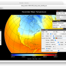
Panoply for Mac 5.4.3 freeware
Panoply for Mac is an utility that enable user to plot raster image. Depending on the data, it can draw global longitude-latitude images or pole-to-pole latitude-vertical images.Panoply is a cross-platform application which plots geo-gridded arrays from netCDF, HDF and GRIB datasets. The utility can also combine two arrays and can project the analysis using more than 100 maps. ...
| Author | Robert B. Schmunk |
| Released | 2024-06-24 |
| Filesize | 36.40 MB |
| Downloads | 871 |
| OS | Mac OS X |
| Installation | Instal And Uninstall |
| Keywords | plot raster image, longitude image, pole-to-pole image, raster image, rasterize, raster |
| Users' rating (38 rating) |
Panoply for Mac Free Download - we do not host any Panoply for Mac torrent files or links of Panoply for Mac on rapidshare.com, depositfiles.com, megaupload.com etc. All Panoply for Mac download links are direct Panoply for Mac download from publisher site or their selected mirrors.
| 5.4.3 | Jun 24, 2024 | New Release | |
| 5.4.1 | Jun 1, 2024 | New Release | |
| 5.4.0 | May 11, 2024 | New Release |


