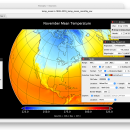
Panoply for Mac 5.4.3 freeware

... an utility that enable user to plot raster image. Depending on the data, it can draw global longitude-latitude images or pole-to-pole latitude-vertical images.Panoply is a cross-platform application which plots geo-gridded arrays from netCDF, HDF and GRIB datasets. The utility can also combine two arrays and can project the analysis using more than 100 maps. ...

Author Robert B. Schmunk
Released 2024-06-24
Filesize 36.40 MB
Downloads 808
OS Mac OS X
Installation Instal And Uninstall
Keywords plot raster image, longitude image, pole-to-pole image, raster image, rasterize, raster
Users' rating
(30 rating)
Panoply for MacCADMac OS X
Panoply for Mac - generate image Freeware Download Notice

Panoply for Mac Free Download - we do not host any Panoply for Mac torrent files or links of Panoply for Mac on rapidshare.com, depositfiles.com, megaupload.com etc. All Panoply for Mac download links are direct Panoply for Mac download from publisher site or their selected mirrors.

Panoply for Mac freeware - The Latest User Reviews
Panoply for Mac freeware - The Latest Versions History
5.4.3 Jun 24, 2024 New Release
5.4.1 Jun 1, 2024 New Release
5.4.0 May 11, 2024 New Release

Most popular CAD freeware downloads

Panoply for Mac

5.4.3 freeware download

... and other types of databases, in order to generate geo-gridded plots. Since the application deploys on the ... other types of masks on top of the generated arrays. You can: Create color ...

TNTmips

20240404 freeware download

... with virtually any type of geospatial data including imagery, terrain surfaces, and map data with associated database ... without importing. Overlay your geodata on Bing Maps imagery and maps or on geodata layers published on ...

DSI Studio

.59 freeware download

... Studio are distributed computing and multithread calculation to generate tractographies as well as the ultrafast 3D engine ... (DSI) · Generalized Q-sampling Imaging (GQI) Supported image format: · DICOM (multi-slices/mosaic) · Analyze/NIFTI · bruker ...

Techne CAD/CAM

1.0.31.0 RC freeware download

... users will layout their design and then immediately generate CNC code. The goal is a design ... Flip or mirror designs Manually trace over bitmap image Grid layout with snap to line option ...

Mobile Atlas Creator

2.2.1 freeware download

... maps can be exported as one large PNG image with calibration MAP file for OziExplorer. As source ... OSMtracker (Windows Mobile/Pocket PC) OziExplorer (single 24bit PNG image with calibration (MAP) file PathAway (Windows Mobile) RMaps ...

Techne CAD/CAM x64

1.0.31.0 RC freeware download

... users will layout their design and then immediately generate CNC code. The goal is a design ... Flip or mirror designs Manually trace over bitmap image Grid layout with snap to line option ...

Mobile Atlas Creator for Mac OS X

2.2.1 freeware download

... maps can be exported as one large PNG image with calibration MAP file for OziExplorer. As source ... OSMtracker (Windows Mobile/Pocket PC) OziExplorer (single 24bit PNG image with calibration (MAP) file PathAway (Windows Mobile) RMaps ...

QFitsView

8.6 freeware download

... core, DS9 excels in displaying and analyzing astronomical images, supporting a wide array of file formats including ... noteworthy, ensuring that users can work with high-resolution images without performance bottlenecks. One of DS9's standout ...

S-Attractor

1.00 freeware download

The program shows strange attractor. The static image is not enough interestingly, but when it is transformed at change of parameters... Is on what to ...

VEGA ZZ

3.2.3.28 freeware download

... PDBQT multi-model formats. Snapshot, hardware and software image rendering with the capability to create images bigger than the monitor size. The software rendering ...