Mobile Atlas Creator for Mac OS X 2.2.1 freeware

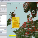
Mobile Atlas Creator is a small, simple, Java based application specially designed to help you create atlases for TrekBuddy. Basically this software will create offline atlases for GPS handhelds and cell phone applications like TrekBuddy, AndNav and other Android and WindowsCE based applications. ...

Author Fredrik Moller
Released 2021-06-02
Filesize 15.00 MB
Downloads 1843
OS Mac OS X
Installation Instal And Uninstall
Keywords create atlas, generate atlas, atlas creator, generator, generate, create
Users' rating
(24 rating)
Mobile Atlas Creator for Mac OS XCADMac OS X
Mobile Atlas Creator for Mac OS X - generate file Freeware Download Notice

Mobile Atlas Creator for Mac OS X Free Download - we do not host any Mobile Atlas Creator for Mac OS X torrent files or links of Mobile Atlas Creator for Mac OS X on rapidshare.com, depositfiles.com, megaupload.com etc. All Mobile Atlas Creator for Mac OS X download links are direct Mobile Atlas Creator for Mac OS X download from publisher site or their selected mirrors.

Mobile Atlas Creator for Mac OS X freeware - The Latest User Reviews
Mobile Atlas Creator for Mac OS X freeware - The Latest Versions History
2.2.1 Jun 2, 2021 New Release
2.1.1 Rev 23 Apr 20, 2015 New Release Changed the MOBAC web site URL (e.g. used for online update):
Map source initialization by atlas creation engine added (fix for #313)
Multi-threading issue with TileImageWriter fixed
2.0.0 Alpha Apr 20, 2015 New Release Mapsforge vector maps library updated to 0.5.1
Mapsforge custom caching implemented (required for correct label rendering)

Most popular CAD freeware downloads

FilterPro Desktop

3.1.0.23446 freeware download

... filters now accounts for passband ripple Supports design file migration from FilterPro v2 so that designs created ... can benefit from the functionality of v3.1. Easily generate schematics, view frequency and time responses, and print ...

Gmsh

4.13.1 freeware download

... CAD engine and post-processing tool, enabling you to generate 3D mesh. It comes packed with a few ... translate, rotate, scale), physical groups (coherence, reload, edit file), define one, two and three dimensions, as well ...

Mobile Atlas Creator for Mac OS X

2.2.1 freeware download

... as one large PNG image with calibration MAP file for OziExplorer. As source for an offline atlas ... Trail Explorer (J2ME) - single tiles and MTECache file NaviComputer (Windows Mobile) nfComPass (WinCE, WinMobile, WinXP) OruxMaps ...

OpenDCL Studio

9.1.5.2 freeware download

OpenDCL is a handy, easy-to-use and accessible insturment that is specially designed for AutoLISP programmers that want to replace AutoCAD's limited DCL. They can replace ...

ChannelStorage

1.0.0.0 freeware download

... is a lightweight application that allows you to generate a rating file with the parameters of the depth-flow-storage for a trapezoid channel. These files are used by the GetMapArea application for the ...

Model Air Design

2.4 freeware download

... does not provide measurements and it does not generate line drawings that would help in creating airplane model plans. However, it can export a model file that can be used by most CAD programs. ...

SCaVis

2.3 freeware download

... data analysis, linear or non-linear fits, cluster analysis, generate random numbers, construct neural networks etc. Comprehensive API ... AIDA data formats. Finally, it uses several platform-neutral file formats, including the compressed Google's Protocol Buffers format. ...

5 freeware award

TNTmips

20240404 freeware download

... Map Service (WMS), and ArcIMS ... Automatically generate hundreds to thousands of control points using a ... an unsurpassed number of raster, geometric, and database file formats; convert between data types; and link to ...

VIPER

3.49 B467 freeware download

... mass. It can read MS data from several file formats: .PEK, .CSV (Decon2LS format), .mzXML, and .mzData. See the Readme.txt file installed with VIPER for additional details on the ...

TNTmips for Mac OS X

20240111 freeware download

... Web Map Service (WMS), and ArcIMS. Automatically generate hundreds to thousands of control points using a ... an unsurpassed number of raster, geometric, and database file formats; convert between data types; and link to ...