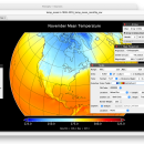
Panoply for Mac 5.4.3 freeware

Panoply for Mac is an utility that enable user to plot raster image. Depending on the data, it can draw global longitude-latitude images or pole-to-pole latitude-vertical images.Panoply is a cross-platform application which plots geo-gridded arrays from netCDF, HDF and GRIB datasets. The utility can also combine two arrays and can project the analysis using more than 100 maps. ...

Author Robert B. Schmunk
Released 2024-06-24
Filesize 36.40 MB
Downloads 769
OS Mac OS X
Installation Instal And Uninstall
Keywords plot raster image, longitude image, pole-to-pole image, raster image, rasterize, raster
Users' rating
(29 rating)
Panoply for MacCADMac OS X
Panoply for Mac - freeware mac Freeware Download Notice

Panoply for Mac Free Download - we do not host any Panoply for Mac torrent files or links of Panoply for Mac on rapidshare.com, depositfiles.com, megaupload.com etc. All Panoply for Mac download links are direct Panoply for Mac download from publisher site or their selected mirrors.

Panoply for Mac freeware - The Latest User Reviews
Panoply for Mac freeware - The Latest Versions History
5.4.3 Jun 24, 2024 New Release
5.4.1 Jun 1, 2024 New Release
5.4.0 May 11, 2024 New Release

Most popular CAD freeware downloads

Panoply for Mac

5.4.3 freeware download

Panoply for Mac is a cross-platform application which plots geo-gridded arrays from netCDF, HDF and GRIB datasets. Panoply is designed to help you view and ...

TNTatlas for Mac OS X

2024 B20240508 freeware download

TNTatlas is a powerful free geodata viewer that lets you publish and distribute your maps and geospatial data — from a single geodata file to complex ...

MagicPlot Student for Mac OS X

2.9.3 freeware download

MagicPlot is a handy tool for scientific and engineer data processing, plotting and nonlinear fitting. MagicPlot is powerful enough and consistent. Advantages: * Compact: ...

Mobile Atlas Creator for Mac OS X

2.2.1 freeware download

Mobile Atlas Creator (formerly known as TrekBuddy Atlas Creator) is an open source (GPL) program which creates offline atlases for GPS handhelds and cell phone applications ...

PAST for Mac OS X

4.03 freeware download

Past is free software for scientific data analysis, with functions for data manipulation, plotting, univariate and multivariate statistics, ecological analysis, time series and spatial analysis, morphometrics ...

TNTmips for Mac OS X

20240111 freeware download

TNTmips for Mac is a complete Geographic Information System (GIS) that lets you work with virtually any type of geospatial data including imagery, terrain surfaces, ...

EnCalc

4.2 freeware download

... Server 2008, 2012, 2016, & 2019) Compatible with Mac OS X Yosemite (10.10.5) to the latest MacOS ... prefs file (Loans, etc.) with other Windows and Mac computers Updated! User Interface received a complete overhaul ...

MedINRIA for Mac OS X

3.2.0 freeware download

MedINRIA is a software that provides a lot of features concerning medical image analysis, especially for DTI analysis and fiber tracking, but also some extra tools ...

Aqsis Renderer for Mac OS X

1.8.2 freeware download

... to the RenderMan standard Aqsis for Mac OS X is a cross-platform photorealistic 3D rendering solution, adhering to the RenderMan interface standard defined ...

MagicPlot Calculator for Mac OS X

1.1 freeware download

MagicPlot Calculator is a free scientific formula calculator from MagicPlot graphing application. A fast and usable calculator to compute complex formulas! Features: Syntax highlighting ...