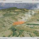
Virtual Terrain Project for Mac OS X and Linux 1.1 110804 freeware

... VTP is to foster the creation of tools for easily constructing any part of the real world in interactive, 3D digital form.

This goal will require a synergetic convergence of the fields of CAD, GIS, visual simulation, surveying and remote sensing. VTP gathers information and tracks progress in areas such as procedural scene construction, feature extraction, and rendering algorithms. ...

Author Ben Discoe
Released 2011-09-08
Filesize 2.20 MB
Downloads 380
OS Linux, Mac OS X
Installation Instal And Uninstall
Keywords libraries, demos, data, open source, VirtualTerrain Project, CAD, GIS, VTP
Users' rating
(12 rating)
Virtual Terrain Project for Mac OS X and LinuxCADLinux, Mac OS X
Virtual Terrain Project for Mac OS X and Linux - for Freeware Download Notice

Virtual Terrain Project for Mac OS X and Linux Free Download - we do not host any Virtual Terrain Project for Mac OS X and Linux torrent files or links of Virtual Terrain Project for Mac OS X and Linux on rapidshare.com, depositfiles.com, megaupload.com etc. All Virtual Terrain Project for Mac OS X and Linux download links are direct Virtual Terrain Project for Mac OS X and Linux download from publisher site or their selected mirrors.

Virtual Terrain Project for Mac OS X and Linux freeware - The Latest User Reviews
Virtual Terrain Project for Mac OS X and Linux freeware - The Latest Versions History
1.1 110804 Sep 8, 2011 New Release Enviro:
Exposed support for more stereo modes: Horizontal and Vertical split.
Options to enable joystick and spacenavigator, rather than just always using them if present.
Smooth continuous update when making buildings.
Option to constrain building point to right angles. Deter user from making bad points.
Made support for Collada (.dae) more explicit in the UI.
Display the version number in the startup dialog.
Added 'every N meters' option to Contour dialog, making it significantly more useful.
Changed 'Move' mode to use Alt modifier key for up/down, to be consistent.
Fixed issues with: support for elevation grids with non-unit vertical scale; removing layers from a terrain; saving snapshot and high-resolution snapshot; buildings with a Geographic CRS; draping of 2D polylines on terrain with vertical exaggeration.

VTBuilder:
Raw layers: Draw polygon holes as dotted lines to tell them from outer edges.

Most popular CAD freeware downloads

FilterPro Desktop

3.1.0.23446 freeware download

... active filter design software is free and available for download now. FilterPro v3.1 Active Filter Design ... the following features: NEW Differential Multiple-Feedback topology for Low-pass, High-pass, and Band-pass filters NEW Support for ...

Panoply for Mac

5.4.3 freeware download

Panoply for Mac is a cross-platform application which plots geo-gridded ... map plots. Use any of numerous color tables for the scale colorbar, or apply your own custom ...

Model Air Design

2.4 freeware download

Model Aircraft Design software for Windows PC. Model Air Design is the new, ... create airplane models. It's a modern software tool for model aircraft design. Model Air Design is for ...

AutoCAD Mobile

5.5.0.0 freeware download

AutoCAD® mobile app has core design and drafting tools. Work on your CAD drawings anytime, anywhere-even offline. The AutoCAD® mobile app includes an easy-to-use interface and ...

Woodland Potential Calculator

2.01 freeware download

... It is designed to calculate the potential for increasing the extent of tree cover across the ... commissioned a bespoke data collection and presentation tool for calculating the potential for increasing the extent of ...

Home Plan Viewer

2.2.2.2 freeware download

... it away, just don't sell it or charge for its use. If it makes you want ... the better. Home Plan Pro is available for a thirty day evaluation. ...

MarvinSketch

23.16.0 freeware download

... includes many editing tools as well as support for bond and atom properties, molecule drawing and many more. MarvinSketch has a rich support for atom and bond properties. Users can assign stereochemistry, ...

QGIS for Linux

3.36.1 freeware download

... its evolution and is being used by many for their daily GIS data viewing needs. QGIS supports ... some key features of "QGIS": · Support for spatially enabled PostgreSQL tables using PostGIS · Support ...

Freeship Plus

3.43+ freeware download

... under license GNU GPL. FREE!ship Plus it intended for the full parametric analysis of resistance and power prediction for a ship and other calculations of hydrodynamics of ...

Antenna Design Calculator

2.3 freeware download

... calculator provides quick estimation of antenna size required for a given gain and frequency. 3 dB and ... the calculator additionally gives the far-field range required for a given antenna. Most of this information is ...