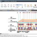
ZWCAD Viewer 2017 freeware

Free ZWCAD Viewer for CAD DWG File Viewing and Plotting. ZWCAD Viewer runs on different ... be viewed in all kinds of frequently used file formats like dwg, dwf, dwfx, dxf and dwt. ZWCAD Viewer is able to measure distance between objects, area of a closed shape, mass and volume of a 3D model, regions or coordinates on the drawings. ...

Author ZWCAD Design Co., Ltd
Released 2016-03-28
Filesize 161.95 MB
Downloads 327
OS Win2000, Windows XP, Windows 7 x32, Windows 7 x64, Windows 8, Windows 10, WinServer, WinOther, Windows Vista, Windows Vista x64
Installation Install and Uninstall
Keywords ZWCAD, DWG CAD, DWG Viewer, AutoCAD free download, free download CAD, AutoCAD, PDF print, PDF plotting
Users' rating
(18 rating)
ZWCAD ViewerCADWin2000, Windows XP, Windows 7 x32, Windows 7 x64, Windows 8, Windows 10, WinServer, WinOther, Windows Vista, Windows Vista x64
ZWCAD Viewer - file tools Freeware Download Notice

ZWCAD Viewer Free Download - we do not host any ZWCAD Viewer torrent files or links of ZWCAD Viewer on rapidshare.com, depositfiles.com, megaupload.com etc. All ZWCAD Viewer download links are direct ZWCAD Viewer download from publisher site or their selected mirrors.

ZWCAD Viewer freeware - The Latest User Reviews
ZWCAD Viewer freeware - The Latest Versions History
2017 Mar 28, 2016 New Release Open DWG, DXF, DWF and DWT file formats from version R12 to 2013
Smaller and quicker And it is the interface you are familiar with
Still be free for all following versions
View both 2D objects and 3D models
Zoom and pan, 3D Orbit helps you view with ease
View 3D models in hide mode
View proxy

Most popular CAD freeware downloads

AutoCAD Mobile

5.5.0.0 freeware download

AutoCAD® mobile app has core design and drafting tools. Work on your CAD drawings anytime, anywhere-even offline. ... AutoCAD® mobile app includes an easy-to-use interface and tools to upload, open, create, and edit DWG™ drawings. ...

Gmsh

4.13.1 freeware download

... mesh. It comes packed with a few handy tools for advanced users. Gmsh is a CAD ... translate, rotate, scale), physical groups (coherence, reload, edit file), define one, two and three dimensions, as well ...

Portable MicroDicom x64

2024.2 freeware download

... DICOM format. It is equipped with most common tools for manipulation of DICOM images and it has ... *.bmp, *.gif, etc) Open and save DICOM directory files Display of patient list from DICOMDIR Display images ...

MicroDicom x64

2024.2 freeware download

... DICOM format. It is equipped with most common tools for manipulation of DICOM images and it has ... *.bmp, *.gif, etc) Open and save DICOM directory files Display of patient list from DICOMDIR Display images ...

nanoCAD

5.1.2524.2017 freeware download

... .dwg support. Being the ultimate in 2D design tools, nanoCAD has been built to deliver design and ... - Native *.dwg support. The world's most popular file format for technical documentation - *.dwg - is ...

QGIS for Linux

3.36.1 freeware download

... formats support by the OGR library · MapInfo files · GRASS integration, including view, edit, and analysis ... and multiband RGB) · Export to Mapserver map file · Digitizing support · Map overview · Plugins ...

TNTmips

20240404 freeware download

... with associated database attributes. It provides all the tools you need to view, create, edit, georeference, interpret, ... type of geospatial data. TNTmips provides professional geospatial tools in a single package at an affordable price ...

Engauge Digitizer for Windows

12.0 freeware download

... This open source, digitizing software converts an image file showing a graph or map, into numbers. The image file can come from a scanner, digital camera or ...

5 freeware award

Model Air Design

2.4 freeware download

... users create 3D-model aircrafts. While other dedicated CAD tools come packed with many editing capabilities and parameters ... model plans. However, it can export a model file that can be used by most CAD programs. ...

QGIS

3.36.1 freeware download

... formats support by the OGR library · MapInfo files · GRASS integration, including view, edit, and analysis ... and multiband RGB) · Export to Mapserver map file · Digitizing support · Map overview · Plugins ...