Gephi for Linux 0.10.1 freeware

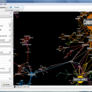
Gephi is a tool for people that have to explore and understand graphs. Like Photoshop but for data, the user interacts with the representation, manipulate the structures, shapes and colors to reveal hidden properties. The goal is to help data analysts to make hypothesis, intuitively discover patterns, isolate structure singularities or faults during data sourcing. ...

Author Mathieu Bastian
Released 2023-01-17
Filesize 142.00 MB
Downloads 762
OS Linux
Installation Instal And Uninstall
Keywords interactive visualization, exploration platform, visualization platform, visualization, exploration, graph
Users' rating
(30 rating)
Gephi for LinuxCADLinux
Gephi for Linux - file tools Freeware Download Notice

Gephi for Linux Free Download - we do not host any Gephi for Linux torrent files or links of Gephi for Linux on rapidshare.com, depositfiles.com, megaupload.com etc. All Gephi for Linux download links are direct Gephi for Linux download from publisher site or their selected mirrors.

Gephi for Linux freeware - The Latest User Reviews
Gephi for Linux freeware - The Latest Versions History
0.10.1 Jan 17, 2023 New Release Bugfixes:
Problem when saving (0.10.0)
Infinite loop when opening project
0.9.2 Sep 26, 2017 New Release New features highlight:
New CSV/Spreadsheet importer migrated to Import API. More user friendly, autodetects imported columns types and data format. Integrated with the rest of file importer formats through import report. Now supports importing excel files.
0.9.1 May 24, 2017 New Release New features highlight

New German localization
Other new or improved features

Implement new mutual edge filter (#1312)
Re-add import wizard support (#1322)
Merge dynamic attributes and timeset when merging parallel edges (#1345)
Hide Edit Window description area (#1354)
Add label properties in Edit (#1355)
Bugfixes

Filter Saved queries not saved in project files (#123)
Filter not applied when opening Gephi file (#734)
SVG, PDF export generate 'null pointer' exception (#1239)
App Hangs - OS X El Capitan (#1241)
Attributes not appearing in Size setting (#1242)
Edge weights are not read (#1243)
Data laboratory shows double precision error decimals for columns with type Float/Double (#1245)
CSV import only show one node (#1247)
Improvements in spreadsheet import and fix default weight when not indicated (#1249)
Multiple edges won't be merged (#1251)
Workspace persistence XML duplicate markup in .gephi (#1262)
Partitions filters not available at start (#1263)
Gexf liststring attribute ty

Most popular CAD freeware downloads

Gmsh

4.13.1 freeware download

... mesh. It comes packed with a few handy tools for advanced users. Gmsh is a CAD ... translate, rotate, scale), physical groups (coherence, reload, edit file), define one, two and three dimensions, as well ...

QGIS for Linux

3.36.1 freeware download

... formats support by the OGR library · MapInfo files · GRASS integration, including view, edit, and analysis ... and multiband RGB) · Export to Mapserver map file · Digitizing support · Map overview · Plugins ...

TNTmips

20240404 freeware download

... with associated database attributes. It provides all the tools you need to view, create, edit, georeference, interpret, ... type of geospatial data. TNTmips provides professional geospatial tools in a single package at an affordable price ...

Portable MicroDicom x64

2024.2 freeware download

... DICOM format. It is equipped with most common tools for manipulation of DICOM images and it has ... *.bmp, *.gif, etc) Open and save DICOM directory files Display of patient list from DICOMDIR Display images ...

MicroDicom x64

2024.2 freeware download

... DICOM format. It is equipped with most common tools for manipulation of DICOM images and it has ... *.bmp, *.gif, etc) Open and save DICOM directory files Display of patient list from DICOMDIR Display images ...

nanoCAD

5.1.2524.2017 freeware download

... .dwg support. Being the ultimate in 2D design tools, nanoCAD has been built to deliver design and ... - Native *.dwg support. The world's most popular file format for technical documentation - *.dwg - is ...

QGIS

3.36.1 freeware download

... formats support by the OGR library · MapInfo files · GRASS integration, including view, edit, and analysis ... and multiband RGB) · Export to Mapserver map file · Digitizing support · Map overview · Plugins ...

Portable MicroDicom

2024.2 freeware download

... DICOM format. It is equipped with most common tools for manipulation of DICOM images and it has ... *.bmp, *.gif, etc) Open and save DICOM directory files Display of patient list from DICOMDIR Display images ...

QGIS for Mac

3.36.1 freeware download

... formats support by the OGR library · MapInfo files · GRASS integration, including view, edit, and analysis ... and multiband RGB) · Export to Mapserver map file · Digitizing support · Map overview · Plugins ...

VIPER

3.49 B467 freeware download

... mass. It can read MS data from several file formats: .PEK, .CSV (Decon2LS format), .mzXML, and .mzData. See the Readme.txt file installed with VIPER for additional details on the ...