Engauge Digitizer for Windows 12.0 freeware

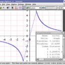
... This open source, digitizing software converts an image file showing a graph or map, into numbers. The image file can come from a scanner, digital camera or ...
The process starts with an image file containing a graph or map. The final result ... digitized data that can be used by other tools such as Microsoft Excel. ...

Author Mark Mitchell
Released 2019-08-19
Filesize 10.60 MB
Downloads 906
OS Windows 2000, Windows 2003, Windows XP, Windows Vista, Windows Vista x64
Installation Instal And Uninstall
Keywords digitize image, image to number, process image, digitize, convert, digitizer
Users' rating
(24 rating)
Engauge Digitizer for WindowsCADWindows 2000, Windows 2003, Windows XP, Windows Vista, Windows Vista x64
Our rating 5 freeware award
Engauge Digitizer for Windows - file tool Freeware Download Notice

Engauge Digitizer for Windows Free Download - we do not host any Engauge Digitizer for Windows torrent files or links of Engauge Digitizer for Windows on rapidshare.com, depositfiles.com, megaupload.com etc. All Engauge Digitizer for Windows download links are direct Engauge Digitizer for Windows download from publisher site or their selected mirrors.

Engauge Digitizer for Windows freeware - The Latest User Reviews
Engauge Digitizer for Windows freeware - The Latest Versions History
12.0 Aug 19, 2019 New Release
10.4 Oct 11, 2017 New Release Show warning message when grid line maximum is exceed (#244)
CSV export files have double quotes on fields with internal commas (#243)
Status bar shows all of text for right-to-left languages (#240)
5.1 Dec 24, 2012 New Release Fix for broken point matching, and control of the x/theta axis label.

Most popular CAD freeware downloads

FilterPro Desktop

3.1.0.23446 freeware download

... to Excel. FilterPro active filter design tool allows designers to create and edit active filter ... filters now accounts for passband ripple Supports design file migration from FilterPro v2 so that designs created ...

Gmsh

4.13.1 freeware download

... design goal is to provide a simple meshing tool for academic problems with parametric input and advanced ... which features a built-in CAD engine and post-processing tool, enabling you to generate 3D mesh. It comes ...

QGIS for Linux

3.36.1 freeware download

... formats support by the OGR library · MapInfo files · GRASS integration, including view, edit, and analysis ... and multiband RGB) · Export to Mapserver map file · Digitizing support · Map overview · Plugins ...

Portable MicroDicom x64

2024.2 freeware download

... DICOM format. It is equipped with most common tools for manipulation of DICOM images and it has ... *.bmp, *.gif, etc) Open and save DICOM directory files Display of patient list from DICOMDIR Display images ...

PreviSat

6.1.0.3 freeware download

... position of artificial satellites in real time. The tool is able to offer predictions about satellites’ passes ... details. The results can be exported to TXT file format. PreviSat enables you to manage TLE orbital ...

MicroDicom x64

2024.2 freeware download

... DICOM format. It is equipped with most common tools for manipulation of DICOM images and it has ... *.bmp, *.gif, etc) Open and save DICOM directory files Display of patient list from DICOMDIR Display images ...

TNTatlas for Mac OS X

2024 B20240508 freeware download

... and geospatial data — from a single geodata file to complex map layouts prepared using TNTmips. TNTatlas ... massive sized geodata and will directly display numerous file formats including shapefiles, GeoTIFF, JP2, PNG, MrSID, DXF, ...

nanoCAD

5.1.2524.2017 freeware download

... .dwg support. Being the ultimate in 2D design tools, nanoCAD has been built to deliver design and ... full featured, fast, lightweight and reliable 2D design tool. nanoCAD has been designed with ease of use ...

TNTmips

20240404 freeware download

... with associated database attributes. It provides all the tools you need to view, create, edit, georeference, interpret, ... type of geospatial data. TNTmips provides professional geospatial tools in a single package at an affordable price ...

XCircuit

3.8 freeware download

XCircuit: An Introduction There are drawing programs, and there are schematic capture programs. All schematic capture programs will produce output for inclusion in publications. However, ...