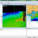
CARIS Easy View 4.2.13 freeware

... of your fly-throughs and save them to AVI files. ...

Author CARIS
Released 2015-08-27
Filesize 106.00 MB
Downloads 479
OS Windows XP, Windows Vista, Windows Vista x64, Windows 7, Windows 7 x64, Windows 8, Windows 8 x64, Windows 10, Windows 10 x64
Installation Instal And Uninstall
Keywords View Spatial Data, View Map, Analyze Map, Map, Model, Surface, Geography
Users' rating
(17 rating)
CARIS Easy ViewCADWindows XP, Windows Vista, Windows Vista x64, Windows 7, Windows 7 x64, Windows 8, Windows 8 x64, Windows 10, Windows 10 x64
CARIS Easy View - file Freeware Download Notice

CARIS Easy View Free Download - we do not host any CARIS Easy View torrent files or links of CARIS Easy View on rapidshare.com, depositfiles.com, megaupload.com etc. All CARIS Easy View download links are direct CARIS Easy View download from publisher site or their selected mirrors.

CARIS Easy View freeware - The Latest User Reviews
CARIS Easy View freeware - The Latest Versions History
4.2.13 Aug 27, 2015 New Release Consistent user experience in 2D and 3D
The properties for coverages have been redesigned and apply both in 2D and 3D. A number of new options are presented including the ability to drape high resolution imagery (e.g. backscatter) over elevations in both 2D and 3D views.
Also, a new user interface is provided to investigate the processing lineage of a dataset recorded in the metadata.
Click to return to top of page
Coordinate reference system enhancements
The coordinate reference system (CRS) functionality has been augmented with EPSG CRS and transformations, such as NTv2. The user interface was upgraded with a new look and with additional capabilities. Users can now build a favourites list, see a list of recently used CRS entries, search for new entries and investigate all aspects of the selected reference system or transformation.
Note that if an incorrect CRS has been selected when opening a dataset in the application, it is now possible to change the CRS in the Properties window wh
4.1.11 Aug 27, 2015 New Release Expanded support for commonly used geospatial data formats (e.g. BAG, GeoTIFF, S-57) and web services (WMS, WCS, WMTS, WTMS).
Upgraded support for non-proprietary BAG format to version 1.5.2, which is the latest
version provided by the Open Navigation Surface Working Group.

Most popular CAD freeware downloads

FilterPro Desktop

3.1.0.23446 freeware download

... filters now accounts for passband ripple Supports design file migration from FilterPro v2 so that designs created in the prior version can benefit from the ...

TNTatlas for Mac OS X

2024 B20240508 freeware download

... and geospatial data — from a single geodata file to complex map layouts prepared using TNTmips. TNTatlas ... massive sized geodata and will directly display numerous file formats including shapefiles, GeoTIFF, JP2, PNG, MrSID, DXF, ...

PyPedal

2.0.3 freeware download

... diversity from pedigrees. Features Reading pedigree files in user-defined formats Checking pedigree integrity (duplicate IDs, ... such as frequency of appearance in the pedigree file Reordering and renumbering of pedigree files Computation of ...

Portable MicroDicom

2024.2 freeware download

... *.bmp, *.gif, etc) Open and save DICOM directory files Display of patient list from DICOMDIR Display images ... images to the most common picture formats, movie file format(.avi) and clipboard Brightness/contrast control Zooming and panning ...

KiCad for Mac OS X

8.0.2 freeware download

... circuits. KiCad allows you to upload NET files and view the selected footprint, record macros, assign hotkeys, and save the generated projects to ZIP file format. Other important options worth mentioning enable ...

Portable MicroDicom x64

2024.2 freeware download

... *.bmp, *.gif, etc) Open and save DICOM directory files Display of patient list from DICOMDIR Display images ... images to the most common picture formats, movie file format(.avi) and clipboard Brightness/contrast control Zooming and panning ...

GstarCAD MC

3.3.1 freeware download

... edit CAD drawings ( DWG, OCF and DXF files) directly on your mobile device after transferring them. ... There is no limit to how large the file is. • Fully compatibility with AutoCAD. (2) No ...

Gmsh

4.13.1 freeware download

... translate, rotate, scale), physical groups (coherence, reload, edit file), define one, two and three dimensions, as well ... the graphical user interface or in ASCII text files using Gmsh's own scripting language. The tool does ...

Cytoscape x64

3.10.0 freeware download

... network and molecular profiling analyses, new layouts, additional file format support, scripting, and connection with databases. Plugins ... supports a lot of standard network and annotation file formats including: SIF (Simple Interaction Format), GML, XGMML, ...

Engauge Digitizer for Mac OS X

12.0 freeware download

... This open source, digitizing software converts an image file showing a graph or map, into numbers. The image file can come from a scanner, digital camera or ...

5 freeware award