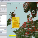
Mobile Atlas Creator for Mac OS X 2.2.1 freeware
Mobile Atlas Creator is a small, simple, Java based application specially designed to help you create atlases for TrekBuddy. Basically this software will create offline atlases for GPS handhelds and cell phone applications like TrekBuddy, AndNav and other Android and WindowsCE based applications. ...
| Author | Fredrik Moller |
| Released | 2021-06-02 |
| Filesize | 15.00 MB |
| Downloads | 1859 |
| OS | Mac OS X |
| Installation | Instal And Uninstall |
| Keywords | create atlas, generate atlas, atlas creator, generator, generate, create |
| Users' rating (30 rating) |
Mobile Atlas Creator for Mac OS X Free Download - we do not host any Mobile Atlas Creator for Mac OS X torrent files or links of Mobile Atlas Creator for Mac OS X on rapidshare.com, depositfiles.com, megaupload.com etc. All Mobile Atlas Creator for Mac OS X download links are direct Mobile Atlas Creator for Mac OS X download from publisher site or their selected mirrors.
| 2.2.1 | Jun 2, 2021 | New Release | |
| 2.1.1 Rev 23 | Apr 20, 2015 | New Release | Changed the MOBAC web site URL (e.g. used for online update): Map source initialization by atlas creation engine added (fix for #313) Multi-threading issue with TileImageWriter fixed |
| 2.0.0 Alpha | Apr 20, 2015 | New Release | Mapsforge vector maps library updated to 0.5.1 Mapsforge custom caching implemented (required for correct label rendering) |


