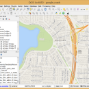
QGIS for Mac 3.36.1 freeware

QGIS supports vector, raster, and database formats and lets you browse and create map data on your computer.
QGIS supports many common spatial data formats (e.g. ESRI ShapeFile, geotiff). QGIS supports plugins to do things like display tracks from your GPS.
QGIS aims to be an easy to use GIS, providing common functions and features. The initial goal was to provide a GIS data viewer. ...

Author Gary Sherman
Released 2024-03-26
Filesize 1600.00 MB
Downloads 748
OS Mac OS X
Installation Instal And Uninstall
Keywords geographic information system, map creator, map viewer, GIS, geographic information, create, QGIS for Mac
Users' rating
(26 rating)
QGIS for MacCADMac OS X
QGIS for Mac - file information Freeware Download Notice

QGIS for Mac Free Download - we do not host any QGIS for Mac torrent files or links of QGIS for Mac on rapidshare.com, depositfiles.com, megaupload.com etc. All QGIS for Mac download links are direct QGIS for Mac download from publisher site or their selected mirrors.

QGIS for Mac freeware - The Latest User Reviews
QGIS for Mac freeware - The Latest Versions History
3.36.1 Mar 26, 2024 New Release
3.36.2 Apr 25, 2024 New Release
3.36.1 Mar 26, 2024 New Release

Most popular CAD freeware downloads

Jmol for Linux

14.31.53 freeware download

... based application designed to display various 3D chemical information. Jmol's features include reading a variety of file types and output from quantum chemistry programs, and ...

Weather Station Data Logger

5.6.0.0 freeware download

... time. Data is also logged to a CSV file with options for automatic backup and trimming. Daily extremes can be extracted from the log file and written to a separate CSV file. Data ...

MOPlot

1.93 freeware download

... populations (for open shell systems), if the corresponding information is available in the output of the calculation. ... optimization can be displayed and saved to a file. · Form linear combinations of vibrations. This feature ...

Jmol

14.31.53 freeware download

... based application designed to display various 3D chemical information. Jmol's features include reading a variety of file types and output from quantum chemistry programs, and ...

OpenRocket

14.06 freeware download

... CP position Real-time flight altitude, velocity and acceleration information from a continuous simulation performed in the background ... configurations Simulation data can be exported to CSV files for further analysis Simulation listeners allowing custom-made code ...

SketchEl

1.60 freeware download

... be easily interconverted with the ubiquitous MDL MOL file format, though not not necessarily without information loss. Molecule diagrams are rendered interactively in high ... based, with features for interconverting with MDL SD files. All of the SketchEl features are written ...

QGIS for Linux

3.36.1 freeware download

... formats support by the OGR library · MapInfo files · GRASS integration, including view, edit, and analysis ... and multiband RGB) · Export to Mapserver map file · Digitizing support · Map overview · Plugins ...

DSI Studio

.59 freeware download

... of passing and/or regions of avoidace. · Supported file format for input ROI: text file, Analyze, NIFTI · Supported file format for output tracts: text file, TrackVis .trk ...

MITO

2.0 freeware download

... MITO toolkit makes it possible to fetch radiological information and images stored in a PACS according to the standard format DICOM, then provides the final ...

Pro Yacht

1.0.0.1 freeware download

... analysis. For the expert designer, the native text file format can be used to overlay flow lines ... introduction of new realisation code to manage all information extracted from surfaces. While the hull transformation functions ...