Jmol 14.31.53 freeware

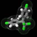
... based application designed to display various 3D chemical information. Jmol's features include reading a variety of file types and output from quantum chemistry programs, and animation of multi-frame files and computed normal modes from quantum programs. ...

Author Egon Willighagen
Released 2021-09-06
Filesize 58.00 MB
Downloads 1831
OS Windows XP, Windows Vista, Windows Vista x64, Windows 7, Windows 7 x64, Windows 8, Windows 8 x64, Windows 10, Windows 10 x64
Installation Instal And Uninstall
Keywords quantum chemistry, 3D viewer, 3D chemical information, chemistry, chemical
Users' rating
(53 rating)
JmolCADWindows XP, Windows Vista, Windows Vista x64, Windows 7, Windows 7 x64, Windows 8, Windows 8 x64, Windows 10, Windows 10 x64
Jmol - file information Freeware Download Notice

Jmol Free Download - we do not host any Jmol torrent files or links of Jmol on rapidshare.com, depositfiles.com, megaupload.com etc. All Jmol download links are direct Jmol download from publisher site or their selected mirrors.

Jmol freeware - The Latest User Reviews
Jmol freeware - The Latest Versions History
14.31.53 Sep 6, 2021 New Release
14.31.35 Mar 17, 2021 New Release
14.31 May 28, 2020 New Release new feature: Switch to Java 7, allowing for string-based switch and Files.readAllBytes().
bug fix: ellipsoids "csa" scale 0.5 on does not scale
bug fix: implicit refresh required after translateSelected
new feature: Gaussian reader reads NMR shielding tensors as "csa"

Most popular CAD freeware downloads

TNTatlas for Mac OS X

2024 B20240508 freeware download

... and geospatial data — from a single geodata file to complex map layouts prepared using TNTmips. TNTatlas ... massive sized geodata and will directly display numerous file formats including shapefiles, GeoTIFF, JP2, PNG, MrSID, DXF, ...

PyPedal

2.0.3 freeware download

... diversity from pedigrees. Features Reading pedigree files in user-defined formats Checking pedigree integrity (duplicate IDs, parents younger than offspring, etc.) Generating summary information such as frequency of appearance in the pedigree ...

DSI Studio

.59 freeware download

... of passing and/or regions of avoidace. · Supported file format for input ROI: text file, Analyze, NIFTI · Supported file format for output tracts: text file, TrackVis .trk ...

QGIS for Linux

3.36.1 freeware download

... formats support by the OGR library · MapInfo files · GRASS integration, including view, edit, and analysis ... and multiband RGB) · Export to Mapserver map file · Digitizing support · Map overview · Plugins ...

eMachineShop 3D CAD

1.52 freeware download

... you start the program via and auto-updating price file. This means designers can do near-real-time design optimization. ... change. Like the price? Enter yrour credit card information and in a few weeks, your finished parts ...

enCIFer for Linux

1.4 freeware download

The Crystallographic Information File (CIF) is the internationally agreed standard file format for information exchange in crystallography. The CIF standard is supported, ... enables users to validate CIFs and ensure their files are format-compliant for deposition with journals and databases ...

Geogiga Front End

9.0 freeware download

... data Resample and cut seismic data Integrate multiple files Support SEG-2, SEG-Y, SEG-D, ASCII, and other data formats Convert other data formats to SEG-2, SEG-Y, ...

wxGIS Portable

0.4.1 freeware download

... manage and to organize multiple types of geographic information. The program has an Explorer-like interface that is ... systems in folders. It also includes a vector file export utility and a tool for correcting the ...

TNTatlas

2024 B20240606 freeware download

... and geospatial data — from a single geodata file to complex map layouts prepared using TNTmips. TNTatlas ... massive sized geodata and will directly display numerous file formats including shapefiles, GeoTIFF, JP2, PNG, MrSID, DXF, ...

TNTmips

20240404 freeware download

TNTmips software is a complete Geographic Information System (GIS) that lets you work with virtually ... an unsurpassed number of raster, geometric, and database file formats; convert between data types; and link to ...